With the tropics remaining active, we’re not seeing much in the way of sustained, deep cold. However, we should be seeing some pattern changes heading into mid-month.
Several models have been juggling cold surges beginning next weekend, which I’ve mentioned in the forecast notes over the past couple of days. There’s quite a bit of variation in outputs because the tropics have not calmed for the season. For sustained cold to come into the Northeast (and even into Great Lakes to an extent), we’ll need the tropics to fizzle out completely. Currently, there are still two areas of interest in the Atlantic. The GFS, and more recently the Euro, have both been flip-flopping on the development of another tropical disturbance in the next 7-10 days. Therefore, the way in which the models materialize the disturbance, changes the depth and geographic area of the incoming cold. Unfortunately, the fluctuations will likely continue into early next week. The current trend leans toward a warmer solution, but it is dependent on how energetic the tropics remain.
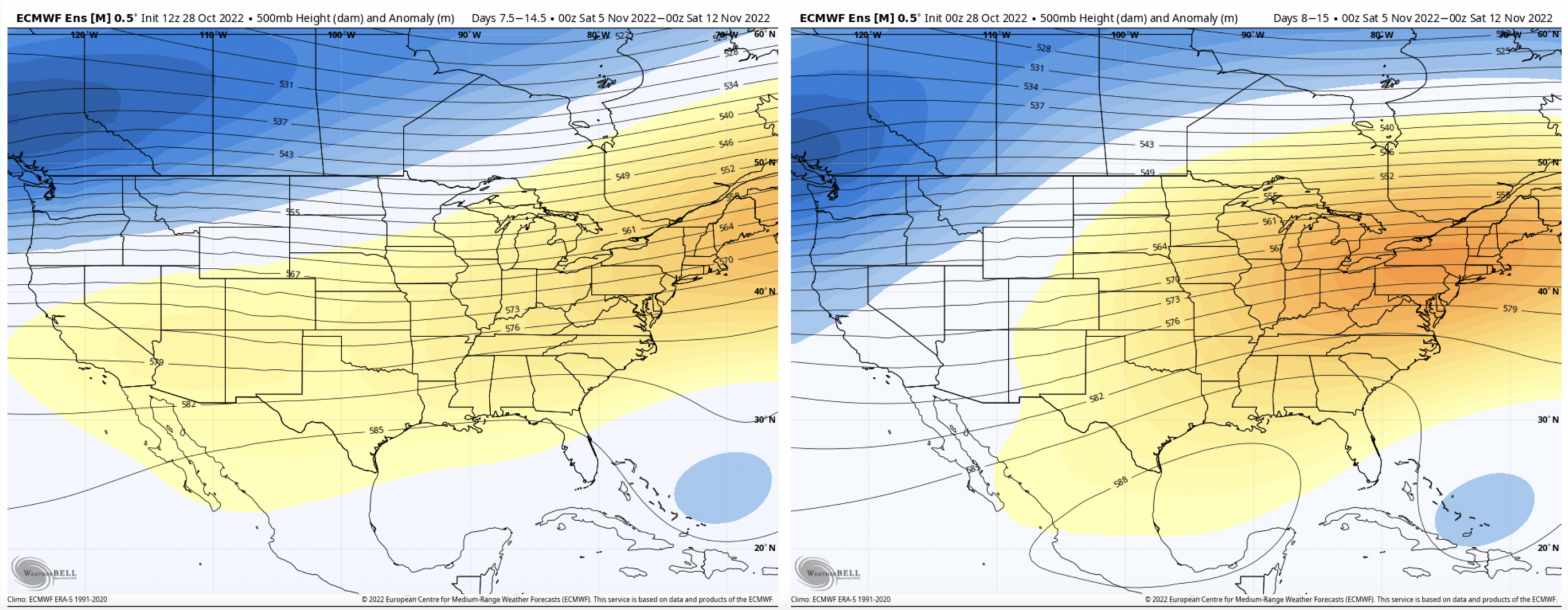
Regardless of what happens in the Nov 6-7 time frame, the overall pattern looks to shift mid-month. We’re starting to see the amplitude of height anomalies flatten out, creating a somewhat zonal flow, which should set the stage for a “season changer” system to develop and move through.

We’re also seeing, more so through the European model recently, an earlier peak of the eastern ridge. In comparing today’s 12z run with the 0z, and the 12z and 0z yesterday, there’s been a continual trend to shift the core of the ridge farther east more rapidly. This is certainly better news for hopefully a quicker transition into a cooler pattern.