Another rainy start to the week for the Northeast as a weak low pressure system continues to bring showers and a couple isolated thunderstorms. We are also watching the tropics for a piece of energy near Bermuda that’s attaining tropical characteristics. The National Hurricane Center actually gives it a high chance of formation in the next 48-72 hours. This is another reason we haven’t seen much cold settle into the Northeast (tropics won’t shut off).
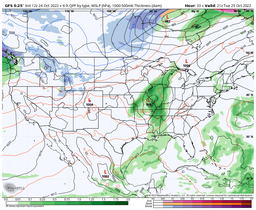
This tropical energy may intertwine with a cold front coming through the Northeast later Wednesday. In the surface map posted, you can see the relatively weak low due east of North Carolina, and the incoming low pressure system in the Midwest. We’ll have watch this closely, as a phasing of the energies could create a more potent coastal system. Right now the timing doesn’t look conducive for this solution, but it’s always a concern heading into the late October/November time period.
By Thursday, we’ll begin to clear and cooler air returns for Friday and the weekend, but not cold enough for snowmaking. We’ll stay dry through the weekend before another system arrives for early next week. We’ve been on the rainy early-week pattern for several weeks now. If trends serve us right, we should have a “disrupter” system arrive in a couple weeks, which could be the catalyst to a cooler pattern settling in.