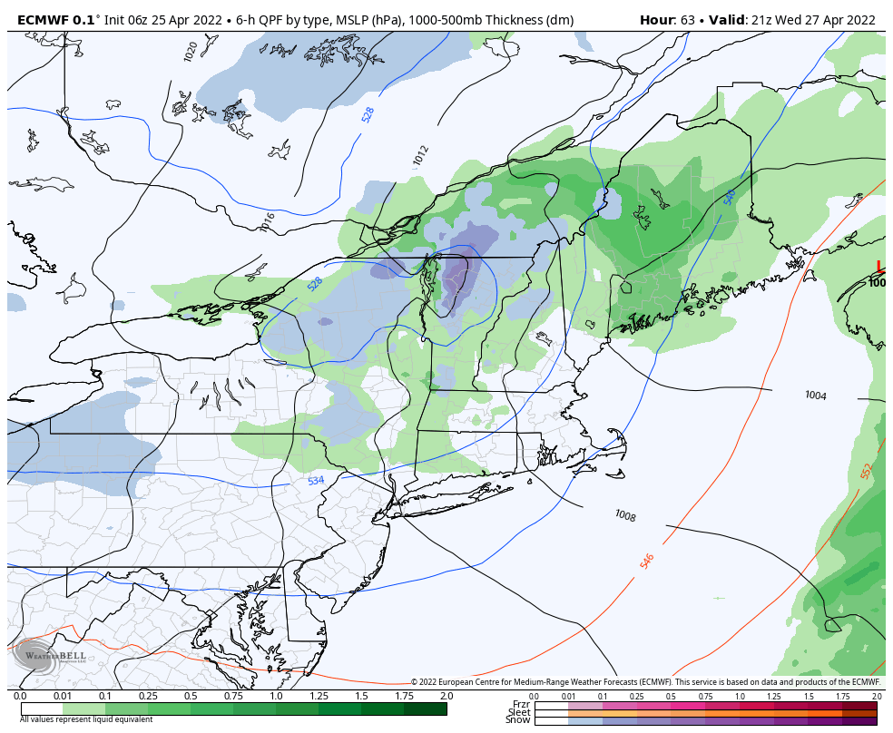
The main feature this week is a cut-off low, which initially brings showers as early as Tuesday morning to the region. Several waves of energy circle around the low this week. However on Wednesday, we’ll see a push of cold air to come in and provide higher changes of snow at higher elevations from Wednesday afternoon through Thursday – possibly Friday in Maine. This energy hovers over Nova Scotia over the weekend, keeping clouds in place for eastern New England. By Sunday we’ll see a resurgence of sunshine and warmer air returning.
However, we’ll keep temperatures overall seasonable to seasonably cold through the first 10 days of May, and more snow changes for higher elevations look to stick around even beyond Mother’s Day weekend.