Another typical spring week begins as we head into the mid-month time frame. Plenty of rain chances along with some warmer days can be expected this week.
We’ll be dealing with a couple hours of rain Tuesday, mostly in the morning, as a weak low pressure moves through the region. Behind it, we clear out and warm up quickly into Tuesday afternoon. Wednesday will be mild, but not quite as warm, as clouds increase with an incoming warm front.
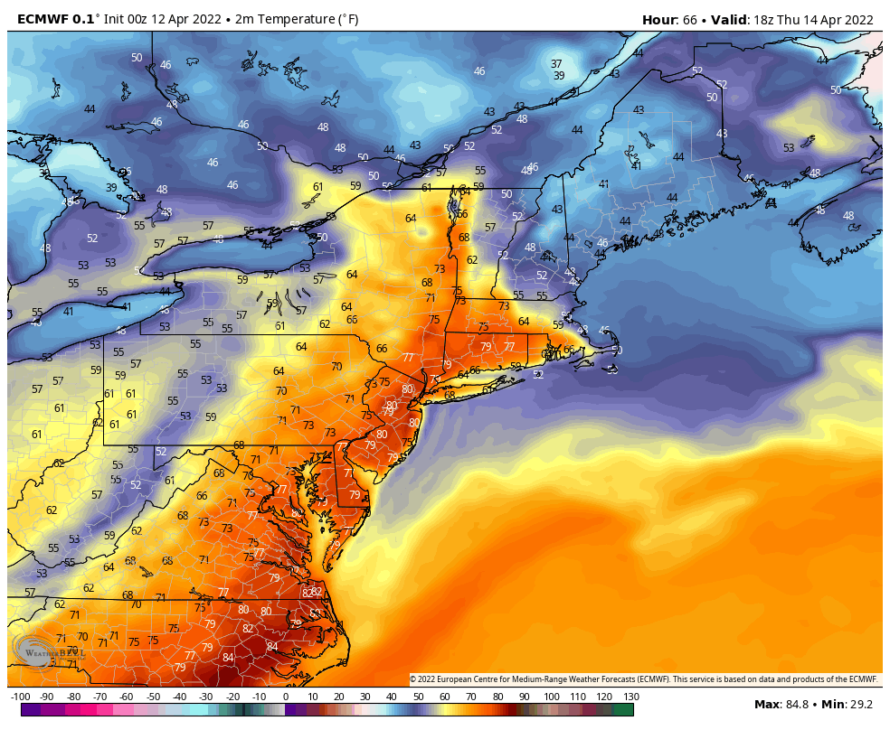
The warm front hits a traffic jam in the Greens, creating a cold air damming scenario into Thursday. This leads to an uneven heating scenario, with far more warmth expected into southern New England as compared to northern areas – well evidenced in the surface temperature pattern shown in the image.
A cold front will come through Thursday evening with showers and possibly thunderstorms, especially in areas that receive ample warming and sunshine during the day Thursday.
Friday and the weekend will be cooler with some unsettled weather continuing. It’s possible to see some snowflakes, especially at higher elevations, heading into Saturday and Sunday.
A cooler pattern lingers into early next week after another strong cold front moves through on Sunday. Expect continued snow chances at higher elevations through the Easter/Passover week.