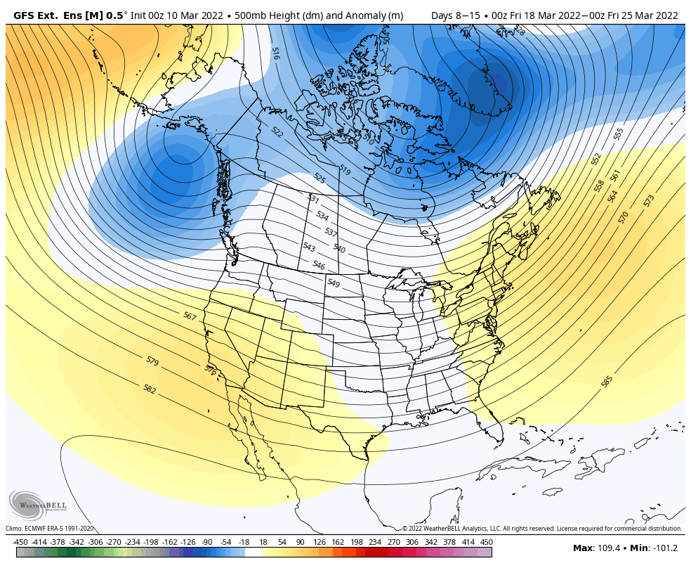
The volatile pattern continues through March with similar warm/cold spells that we’ve been seeing over the past couple of weeks.
The GFS has actually been doing better than the Euro in the long range (7+ days), so I’m going to stick with it for this blog.
Heading into the middle and end of next week, we’ll be seeing a gradual warm up (probably 3-4 days of 40’s & 50’s in the Great Lakes & New England, potentially 60’s for the Mid-Atlantic) that will likely culminate in a non-snow system coming through at some point next weekend. Most models have this system, but how it plays out and the ultimate trajectory is still uncertain.
A trough begins to form in the center of the country, which may move east eventually, but will also set the stage for a continued active pattern across the Great Lakes and the Northeast.
There’s quite decent consensus on the overall cooler pattern for the northern tier of the US through the end of the month. The AO & NAO are projected to head negative after the 19th, which means we could be seeing favorable blocking scenarios occurring.
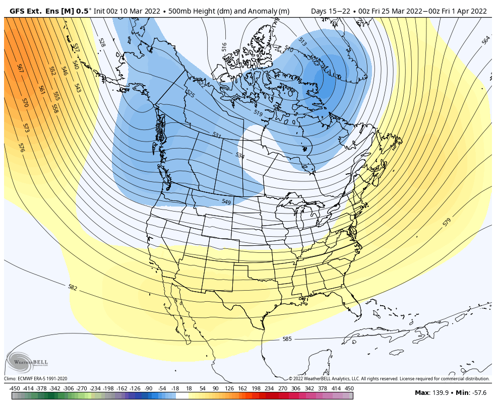
However, the PNA, WPO, and EPO are oddly quiet and near neutral, which paints the picture of local weather patterns taking over instead of large scale, global patterns painting the picture. Ultimately, (and unfortunately) this makes the long range harder to predict, as large scale patterns and trends are the main features we look it. It’s perhaps why the anomalies are fairly weak in week two.