After some non-snow precipitation, we’re back to a slightly colder pattern heading into the midweek. We have a few systems to impact the Northeast and Mid-Atlantic, while the Great Lakes stays pretty quiet.
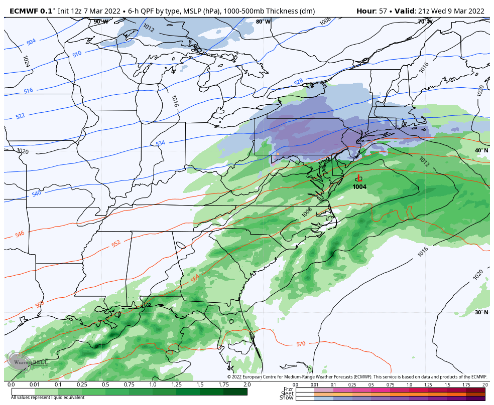
Cold air returns Tuesday with a low pressure system arriving for Wednesday. There’s been a little discrepancy on this one but it looks like things are coming into alignment with a progressive (quick moving) low moving up the eastern seaboard. It has the best dynamics for the Mid-Atlantic, but temperatures are fairly marginal so it will be a wet, heavy snow. Amounts should stay between 2-4″ for PA, 1-3″ in NY, and a bit less into VT/NH/ME.
Before the models were really picking up on the aforementioned system, the weekend system looked much warmer. Now we’re starting to see a colder solution. However, we’re not out of the woods in northern New England – it’s a colder solution mostly for VT/NY and some of MA/NH. The GFS had a colder solution up until yesterday, then it went warm – but the ensembles stayed relatively cool. The Euro had a warm solution for days on end, and then turned colder today, as did the ensembles. A huge shift actually. The Canadian was the coldest, but that’s no surprise. However, the Euro and Canadian ensembles now look pretty similar. Below is a look at the Euro ensembles at 12z and 6z.
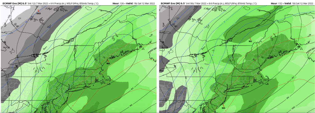
Look at the structure of the red/blue lines. The 0C line is in central NH in the 12z run versus Albany, NY in the 6z run (the precipitation field here does not delineate precipitation type, so this isn’t all rain). The low pressure is in the Gulf of Maine in 12z, versus Sherbrooke, Canada in the 6z. For ensembles to have such a dramatic shift, it’s clear that a piece of data (likely upper air) was sampled in the 12z run that was quite a bit off from what the model was initially estimating. This outcome would bring a significant snow from the Blue Ridge to the Bigelows.
What still remains to be seen is if this is a trend, or it’s a one time shift – or even if the shift was too much. We need a little more time for some consistency after large shifts in tracks. I’m remaining cautiously optimistic as AO/NAO teleconnections are on a downward shift over the weekend. More on this throughout the week.
Behind this system, regardless of track, we have a crash in temperatures. Sunday is expected to be windy with the system departing.