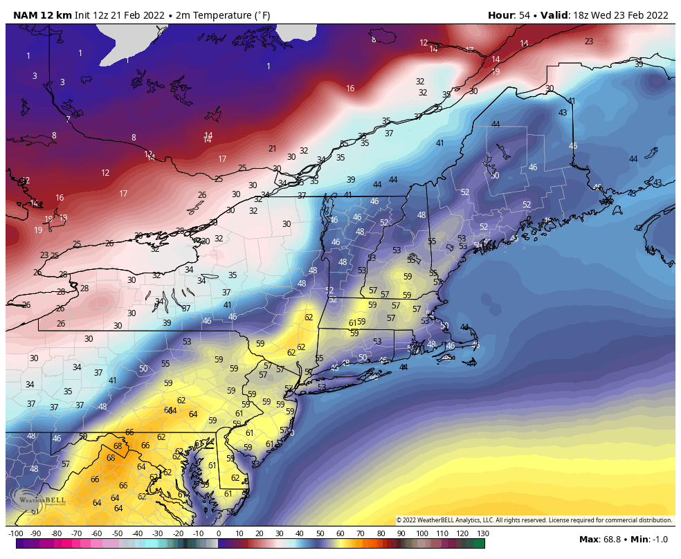
Another messy/warm start to the week for the Northeast; the Great Lakes will be in a better position for frozen precipitation, especially northern areas. The warmup we spoke about the long terms views on 2/11, has arrived. Though shorter than I expected, it’s coming in with another rain event for the Northeast on Tuesday (mixed precipitation and snow for the Great Lakes). General rain amounts likely to be .50-.75″, but could see some locally higher spots.
Monday will be warm temperature wise in the the Northeast, but Wednesday will likely be the warmest ahead of the cold front fully passing through Wednesday evening.
Once the cold front comes through and another flash freeze ensues, we’ll end the bad start to the week, for most of New England at least.
Heading into Thursday, temperatures begin to steady off, though we’re thoroughly entrenched in the cold air mass. We’ll have a low pressure riding up east coast, bringing another round of precipitation to the area. As mentioned in the video blog yesterday, there’s still some concern for mixing in this system, specifically in southern New England and the Mid-Atlantic.
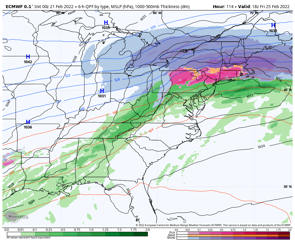
This could provide significant icing in Pennsylvania and the Hudson Valley, while sleet may be more prominent in central NY, MA and possible for portions of southern Vermont.
Because the air mass in northern New England is inherently quite cold, the snow to liquid ratios look rather favorable for a significant snow. We still have a couple days to see the energies come on shore, but current projections look promising for some snowfall replenishment. Notice the very fine line between mixed precipitation and snow – we’ll be watching that closely.
Going into the weekend, we’ll see cold air return behind the system. The pattern looks to be active into early next week, but too early to see if it’s in our favor or offshore due to the strong high pressure.