There’s good news and there’s bad news.
We’ll start with the bad news, as it’s in the short term, and I want to touch on the short-term since it’ll be on our doorstep by the usual Monday Week Ahead blog. The system arriving on Tuesday does not currently look promising for any region, except in the Great Lakes where the cold is better centered in the early part of the week.
Though there could be a brief blast of snow in the beginning of the system Tuesday, it’s likely to transition to a mixed precipitation storm and/or rain for all areas in the Northeast.
This could be another .50-1.00″ of liquid to fall, and though it may not all be rain, areas in PA, southern NY, MA, and southern VT/NH/ME all have low chances of seeing precipitation outside of freezing rain and rain. I will update again on Sunday with specifics on this storm.
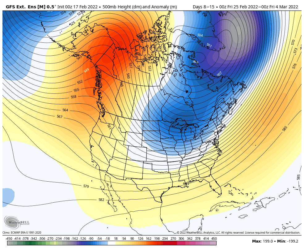
Alright, let’s move on from bad weather woes to some better long term signals for the end of the month and into March. Last week it looked as though the ridge would settle in the east for the last week of February, but now is being shunted out quicker with a negative EPO/WPO being signaled from teleconnections out west.
You can look back to the 2/11 blog and see how different the depiction is now for this time frame (also shows why long term forecasting is difficult and volatile, especially closer to season transitions). This actually places us back in a colder pattern heading into the last weekend of President’s week and through the end of the month, even possibly into mid-March.
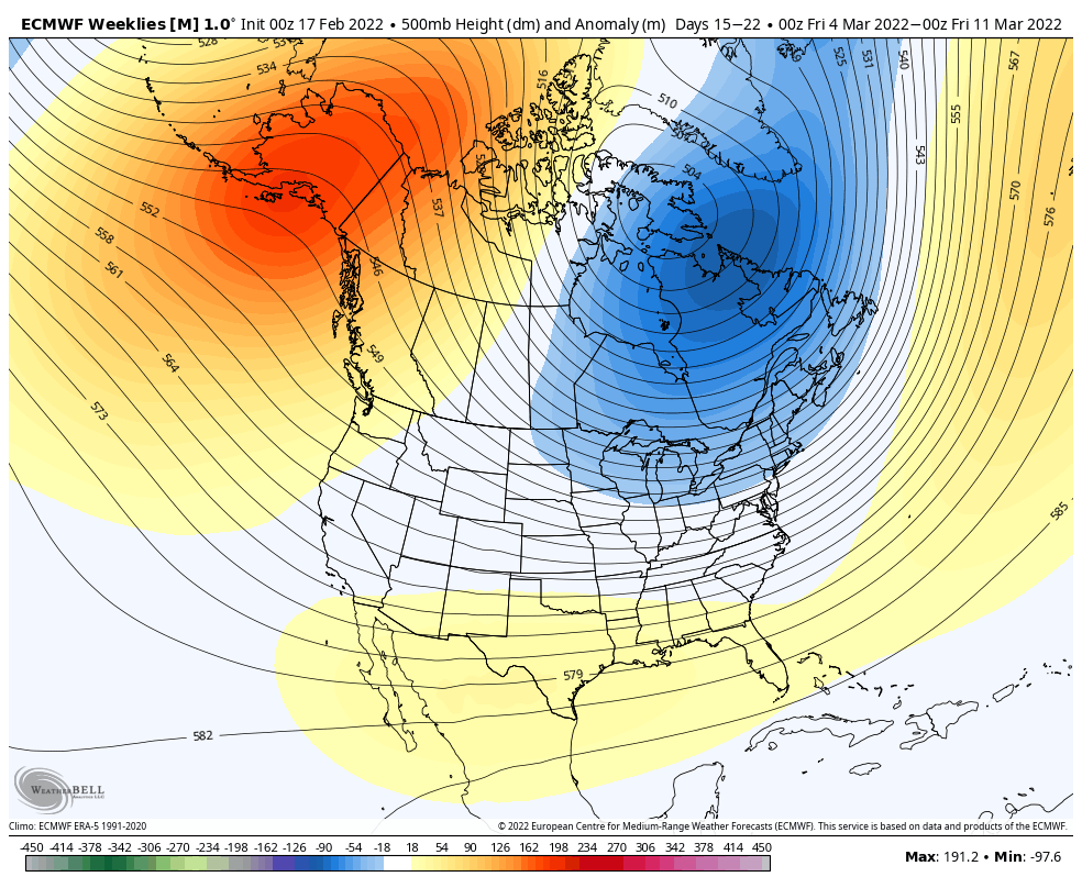
However, somewhat like the cold in January, we’re dealing with a strongly negative PNA, which keeps an overall drier, cold pattern. There are a few moments where the teleconnection sneaks closer to neutral and maybe slightly positive; from Feb 25-Mar 1, and Mar 9-15. It would be at those times that we potentially see some storm opportunities, and given the overall pattern, are more likely to be of the frozen variety of precipitation.

I rarely go out to the 4th week, but the Euro is still seeing an overall cold pattern, which is promising. The trough in the east may ease up, which actually provides an exciting setup for storm tracks, if the cold can hold in place when they come through. AO/NAO’s drop closer to neutral or even slightly negative just after the first of the month through mid-month March – which also coincides with the second time frame the PNA may be less negative. Overall, the trends point to plenty of winter left in the season.