The gradual pattern change is showing its colors these last few days, with some warmer moments and freeze/thaw cycles. We’ll have a cool down early next week; it will be rather substantial cold, but likely our last bout of real cold for several weeks.
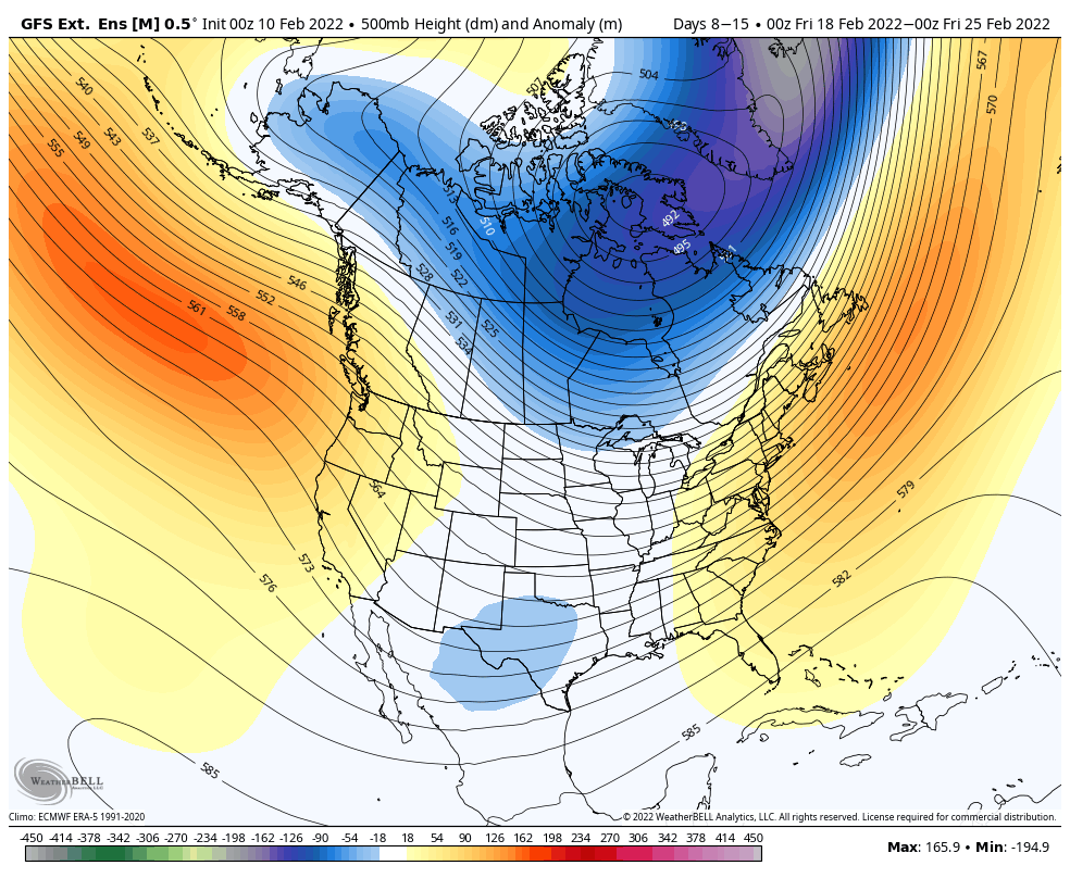
The eastern ridge begins to develop late next week, and therefore by the 2/18-2/25, the east coast is going to be in an overall warmer pattern, with the trough back into the northern Plains. This places the Great Lakes in a more storm friendly pattern (along with some cold still hanging on), as opposed to the Northeast.
We’ll see a storm on 2/18 which looks to be warm for now – behind it, we cool for a quick moment before the warmer pattern settles in.
By the following week, the ridge actually looks to strengthen, centered over the Mid – Atlantic. This, unfortunately, could provide some very abnormally warm days for the Mid Atlantic and Northeast. Even the Great Lakes will begin warming more with the trough now centered to the western part of the country.
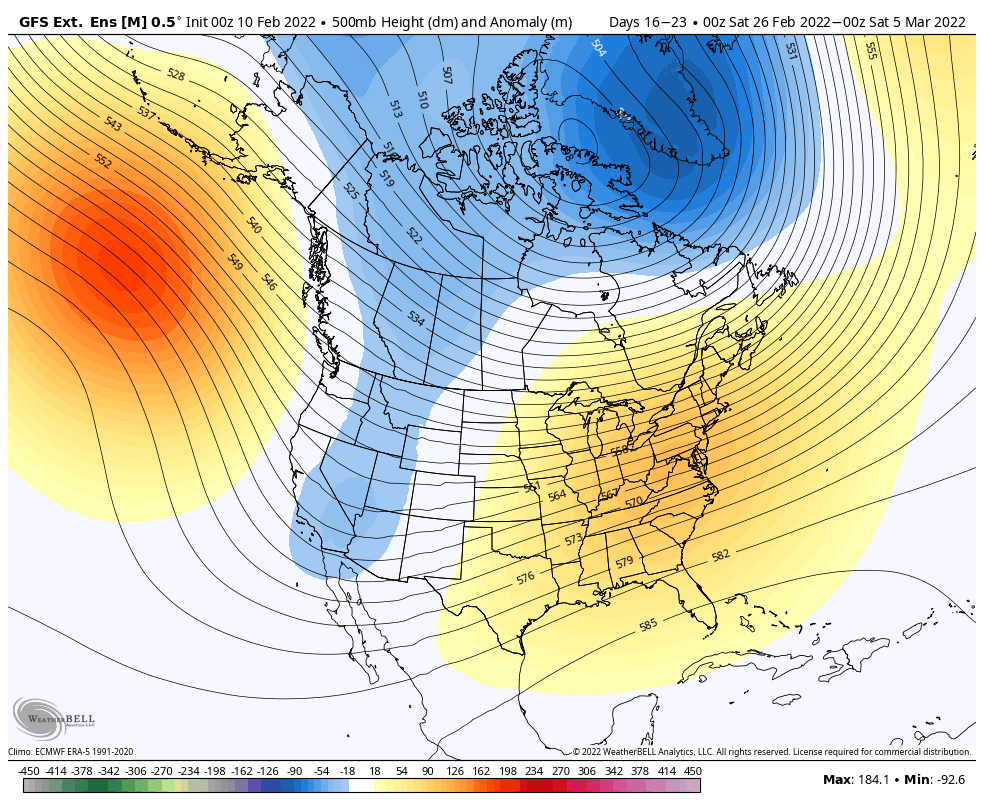
This also looks like a fairly dry pattern for us as well, which in a way, is somewhat better, because without storms the pattern should adjust more quickly (energy balance). Nonetheless, this could be similar to the stretch in March last year that did a number to the snowpack (though provided some fantastic spring ski conditions).
Fear not, this should not be the end of winter, though it may be a long enough warm stretch without much cold or natural snow to have a significant impact on conditions through the vacation weeks of February.
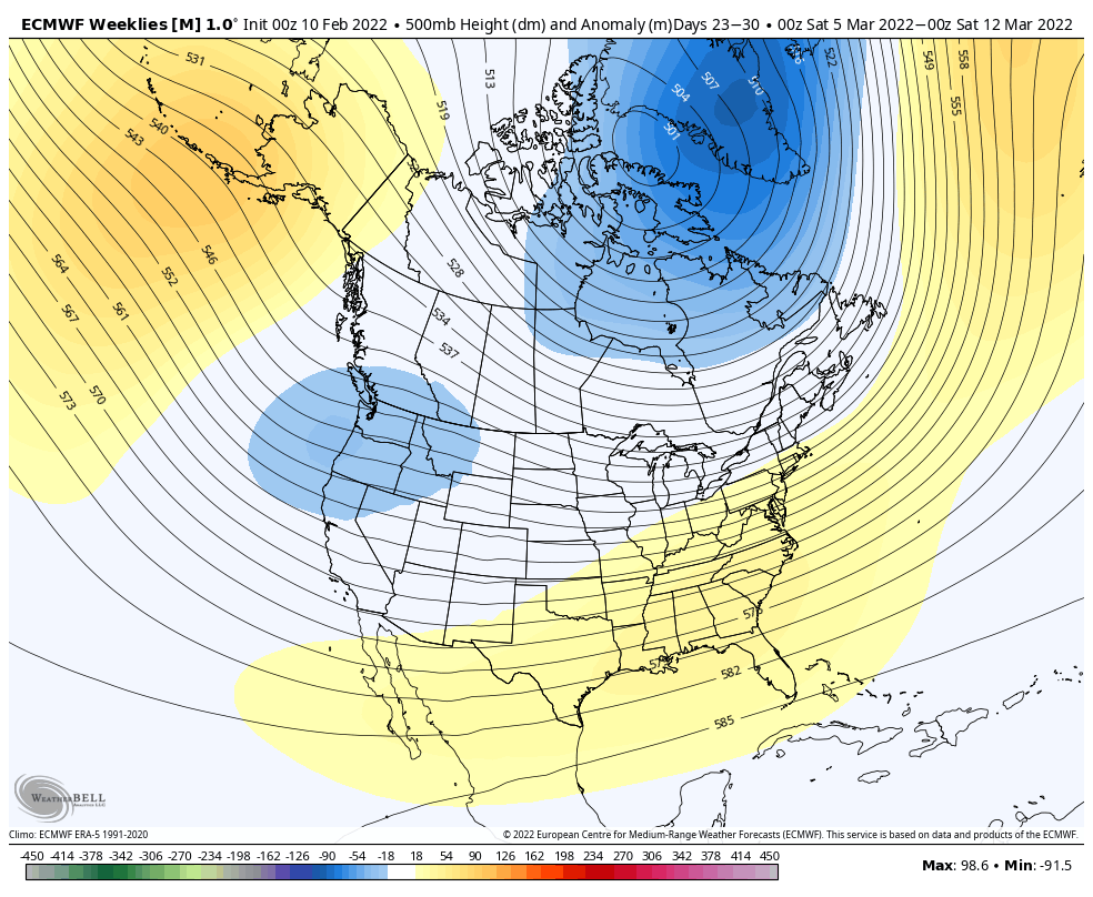
By March, we begin to see a return to some cooler signs – the AO/NAO becoming closer to neutral and EPO/WPO becoming negative – sharply around the first couple of days of March. I show the Euro because it’s seeing cold in the long term, which means there’s likely to be some cold in the long term (and likely to be more pronounced than what it’s showing).