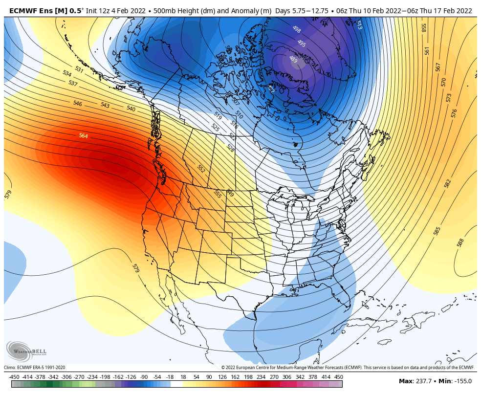
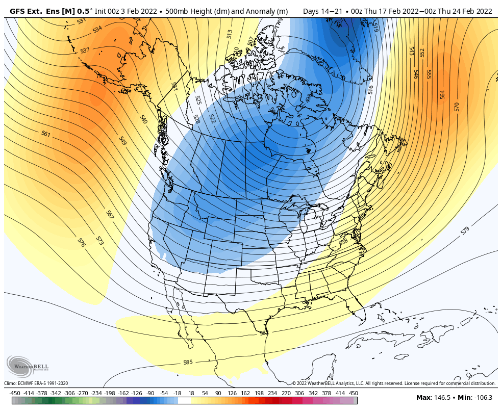
Looking ahead to the second weekend of February and heading into February vacation weeks, we’re looking at an overall temperate pattern. We’ll likely see things on the cooler side for the 2/10-2/17 time frame, especially in the Great Lakes where our trough will begin to break down by the end of the period, eventually situating itself out west.
In terms of the February break time frame, we saw this trend last week in the long term blogs – a far eastern trough developing. That’s initially what we thought the 2/10-2/17 period would be, but the trough held stronger for a little longer. Eventually I do think the eastern ridge will occur, but the farther east it can be, the better outcome we’ll have. Storm tracks remain favorable without a major warm up.
While we may see a mild day here or there, we likely won’t see any “blowtorch” temperatures.
Our teleconnections are a little contradictory – a positive AO/NAO and a neutral to slightly negative EPO, and negative WPO. We can certainly have non-rain storms with a positive AO/NAO, as we’ve seen the past few weeks.