
It’s a cool and quiet start to the week, a nice calm moment before another storm heads our way. And by golly, we’ll get above freezing in some areas this week – brief for the Great Lakes & New England, and a couple days possible in the Mid-Atlantic – though we’ll be clouded up and probably seeing some drizzle or flurries ahead of the incoming system.
By Thursday, a cold front approaching with a low pressure system moving along it – this will affect the Mid-Atlantic and Northeast – a blocking high really limits any impact to the Great Lakes.
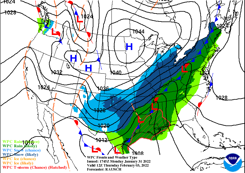
In all honesty, this is going to be another headache to forecast – with precipitation type and accumulation of each type. I’ve posted the projected surface map from the WPC. The low in southeast will move north while the high over the plains moves east – it will shunt the northward movement of the storm (but provide cold air) which is while we’ll see a west-east oriented line instead of a more north-south line.
The speed of the low along the front, and the front itself, make a huge difference in what we will see and where we will see it. There’s been consistency of the shape of this system – more WSW to ENE oriented – and the low moving along it to the ENE.
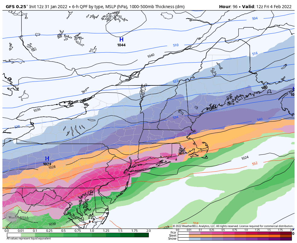
The GFS is the farthest south with the boundary – that provides almost all snow in New England, upstate NY and northern PA – and mixed precipitation into PA, NJ, Hudson Valley, and even south into the MD/WV panhandles and northern Shenandoah Valley. I don’t think it’ll be that cut and dry. This favors the high being stronger and having more “push” on the storm.
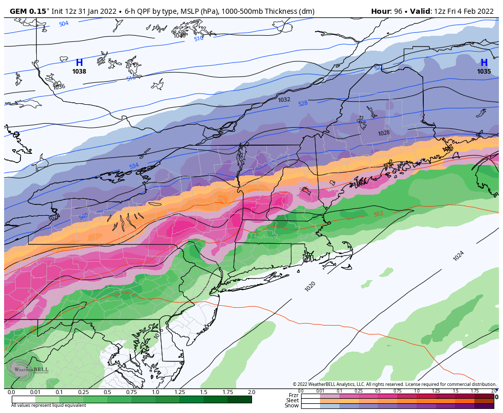
The Canadian is far more bullish on the sleet & freezing rain, which means it sees the cold air at the surface and low levels, but doesn’t believe it will come in the mid and upper levels very quickly – a very slow and methodical transition on a line from Erie, PA – Syracuse, NY – Rutland, VT – Plymouth, NH – Fryeburg, ME. This favors the front moving slower than the low is moving (longer for cold air to move through).
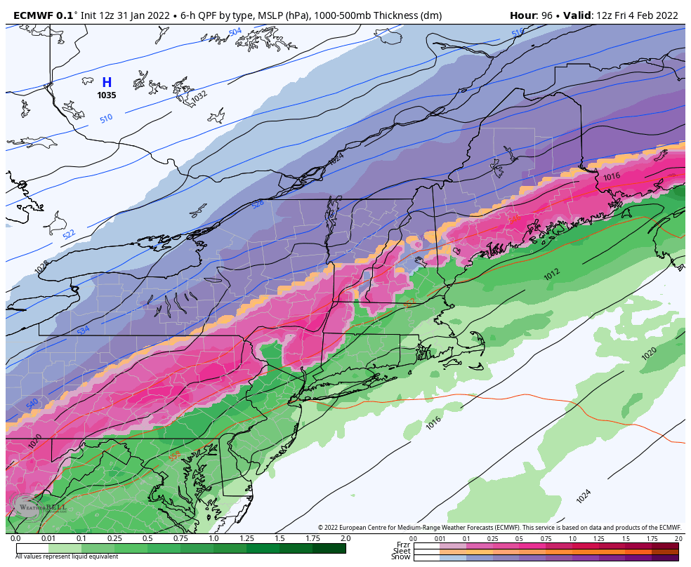
The Euro cuts down of the width of the mixed precipitation line, but likes more freezing rain, a brief transition to sleet and then snow – so it seems the cold coming into the surface levels, but a fairly quick transition (once it happens) of the cold coming into all levels and changing to snow. This favors the front moving faster than the low, and notice the orientation is more north/south than the GFS/Canadian.
These nuances will determine the storm: strength of high, speed/movement of both the low and the front. The speed of the front determines the cold air dispersion while the low speed determines where the cold is when the precip comes through. The strength of the high controls the positioning of the front. I’ve posted the images below for reference.
When things hinge on temperature movements of two variables (front & low pressure) above the surface, we’re inherently at a disadvantage. Hopefully more balloons will be launched with this system as they were last weekend.
Over the weekend, a weak wave moves over the Great Lakes with some light snow, but fails to reach the Northeast. The pattern looks to stay quite busy into the following week.