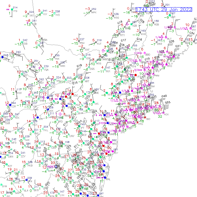

We have the low deepening due south of Cape Cod and some massive snow bands forming for the coast.
All in all, this under performed in PA/NY/NJ per reports from family – about 5″ in Philly, just shy of 10″ in Medford, NJ, and 12.5″ in Ocean City, NJ.
What this is telling me is that the stronger bands have not made it too far inland. Now that can change as it moves farther north and the low strengthens more.
The snow is struggling to move inland into Vermont with the exception of Bennington Windsor, and Windham counties, but we’re seeing moderate snow in Berlin, NH, so I’m wondering if we’re missing some observations out there.
The sensor at Saint Johnsbury is malfunctioning, but I have to imagine there’s some snow making in into the NEK. Because the Burlington, VT radar is basically useless for a nor’easter, we can’t get much information from there. It wasn’t expected to be big for VT, but there was a chance for some minor snow.
So what’s to come? We have some strong bands to come into the coast, and that’s going to expand the precipitation field inland a bit.

The biggest component to this storm is the temperature, and the resultant snow to liquid ratios. They are high. Check out the ratios at 21z (4pm).
That’s really going to amp up the totals. Maine and southern NH areas will certainly win out on this one.
The wind is impacting more areas that snow for the day today, and that wind will elevate even a little more as the storm departs this evening, shifting from the NNE to the NW. That may keep some wind on Sunday.