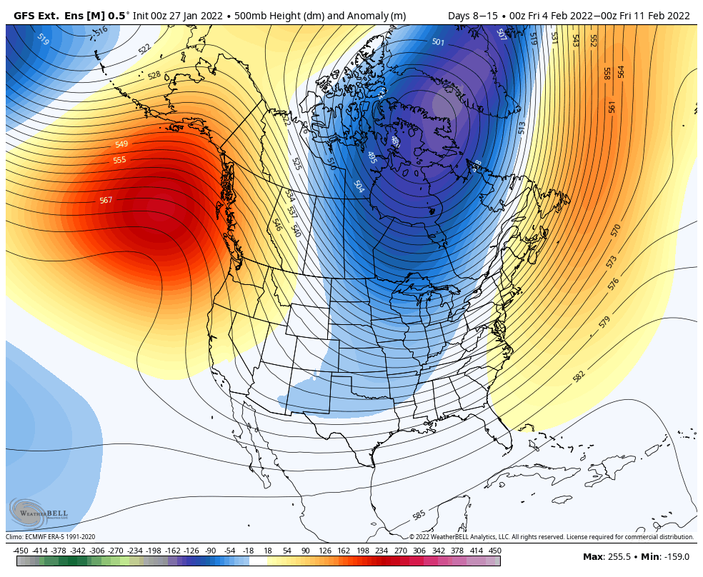
Taking a break from the storm end of things, let’s talk about the long term. No doubt you’ve seen the extended forecast bringing in some not-as-frozen precipitation at the end of next week, which is ill-timed with snow coming to some this weekend. However, it’s kind of necessary to have this happen – it avoids the potential big flip the other way (aka, a blowtorch), later on. But a little eastern ridge develops next week to bring a system 2/3-2/4.
Looking into first full week of February, we’re seeing a little change back to cold behind that system at the end of the week. It looks to crash, which means everything will freeze up solid in areas that receive rain (which look to be most, right now). Behind the initial crash back into the tundra, I think we’ll see near normal to slightly below normal temperatures hang on into the second weekend of February. It’s possible we see that ridging hug the east coast, but I honestly don’t think that’s a bad thing, because storm tracks are mighty favorable with that setup.
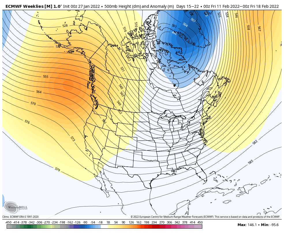
I’m actually going to use the Euro (I know, shocker) for our look into the third week of February, which leads us up to February vacation week. Why use the Euro? Because it’s seeing cold, and if it sees cold in the long-term, you pay attention to it…since it’s seemingly so rare.
It’s trying to continue the pattern seen in the GFS the week before; the ridging off of the east coast and the trough in the Great Lakes. This should reinforce some cold to the Northeast while not blasting us with frigid temperatures. The Great Lakes however, may stay in the tundra for a couple weeks, without much precipitation to speak of given the likely blocking high pressure situated overhead. There will be little breaks of “mild” days here and there, and honestly we want that to avoid an overcorrection in the pattern to more than mild.
Overall, I’d say this pattern will keep things interesting, but we are opening up ourselves to some possible unfrozen events.
And on a side note to my video yesterday, there are actually 3 weather balloon launches in Canada in the NWS network. However, they are only in the provinces of Ontario and Quebec.