Heading into our final week of January, we’re continuing with the cold stretch. A weak impulse of energy brings light snow to the Great Lakes early Monday, and into New England overnight into Tuesday. Fairly light amounts are expected of just a couple inches, with another reinforcing shot of cold air coming in behind it.
The most interesting feature of this week is the possibility of a very strong east coast snowstorm on Saturday. There was a very definitive shift in model data Monday morning, and that was likely the result of sampling from weather balloons in Alaska, which is where the energy is stemming from.
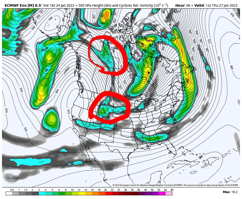
The vorticity image shows the two pieces of energy that shoot down from AK. The bottom one goes into the southern stream, and the top one ends up in the northern stream. Just south of the bottom piece of energy, there’s another elongated area of vorticity extending toward the Pacific. This allows the energy to tap into Pacific moisture.
As these two pieces of energy continue to move, the northern one ends up pushes the southern one in the base of the trough. This also brings the southern stream piece of energy into the Gulf of Mexico, which means we have another place for moisture to increase. A Gulf connection is exactly what we need to bring moisture into a cold, dry air mass.
As the southern stream energy digs, the northern stream piece of energy rounds the trough, and they phase (theoretically) to create this monster low pressure system.
So what can go wrong? Well, plenty still – even 4.5 days away. Phasing too far east/west, miscalculated timing, blocking is too strong…
We’ll keep a close eye on this one! It’s one of the strongest outputs of model data I’ve seen in a long time. Behind this system, we’re back to cold.