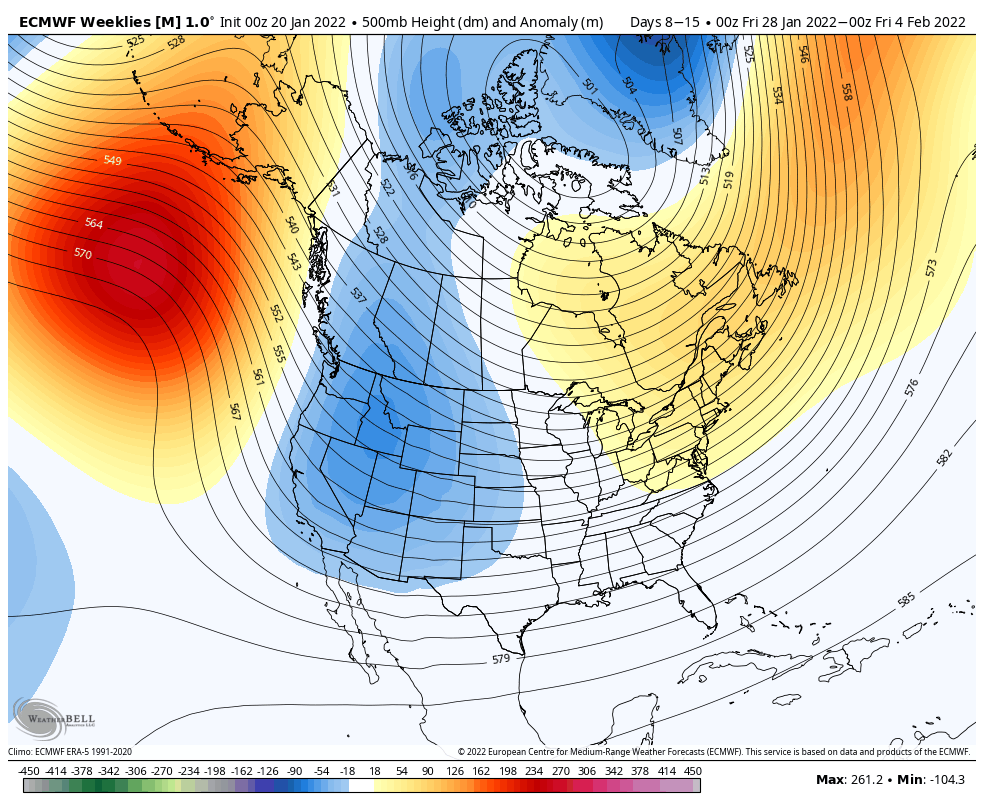
There’s a lot of inconsistency in the long term, so I’m going to focus in the first week of February for now. The Euro, of course, favors the eastern ridge for 1/28, but the GFS/Canadian see differently. I hedge toward the GFS/Canadian because they usually see cold when cold is coming, whereas the Euro is aloof until we arrive closer to the 7 day range.
You’ll notice that the GFS creates a southeast trough with a large high south of Greenland. To be honest, this isn’t the worst pattern for some natural snow. If we get get a piece of energy through the Great Lakes, and something heads up through the trough to fire up a coastal low…we have some very generous blocking from that ridge south of Greenland.
The NAO remains more neutral, while the AO looks to go negative heading into early February. The PNA goes negative, which makes sense with a trough in the east, but since it’s in the southeast, I don’t think it’s as impactful to us.
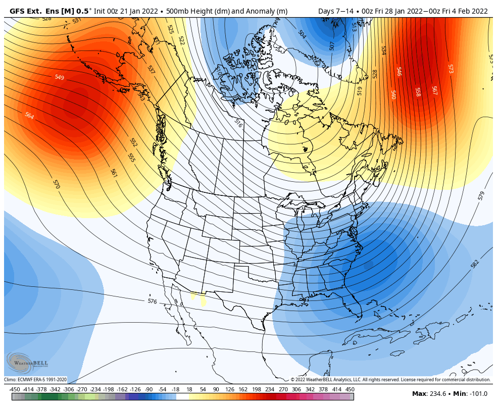
Overall, I think, at least early February, may be a more temperate pattern for us, but we should be in a better place for some natural snow. While it can snow when we are this cold, the arctic high shunts a lot of the activity to the south. I’m not see a blow torch for February, which for now, is a huge win.