There’s not a whole lot going on this week aside from cold, a few small snow chances, and more cold. This is certainly going to be a colder than normal January for us.
A very weak clipper slides through the Great Lakes on Tuesday, and New England on Wednesday, and that’s about all the excitement for the work week.
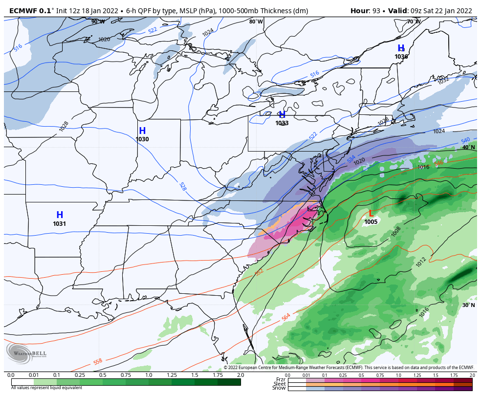
The next relatively interesting system to watch comes this weekend. There’s a stalled boundary in the southern Mid-Atlantic that a low develops on. The path of the low is still uncertain given the other factors at play six days out, but nonetheless it could bring a light snow to the Mid-Atlantic and New England if the track moves a little farther west.
Given the strength of these incoming cold blasts, I’m not overly optimistic on this one. However, the North Atlantic Oscillation is positive, which means we don’t have a ton of blocking going on, which is in our favor.
(Side note: we transition from a ~+1.5 NAO on 1/22 to a ~-2 NAO on 1/25, so that’s a date to watch for storm development).
Cold comes rushing back in behind this low for Sunday 1/23, and not much moderation in temperatures expected for a while.