About two hours ago, I would’ve had a more confident, concise opinion about the storm movement toward a more dominant inland low. However, some of the 12z guidance has shifted more emphasis on the coastal low, and the overarching message is then again, there is not enough information on how the energy transfer is happening between these two lows.
We went over the two possible scenarios in the blog video yesterday. The destructive ice storm in the NAM seems relatively off the table. The snow amounts in PA, NY, VT, NH, MA, and a bit in ME will be affected by which low ends up being dominant. In addition, the consistency of the snow (wet vs dry) will vary as well.
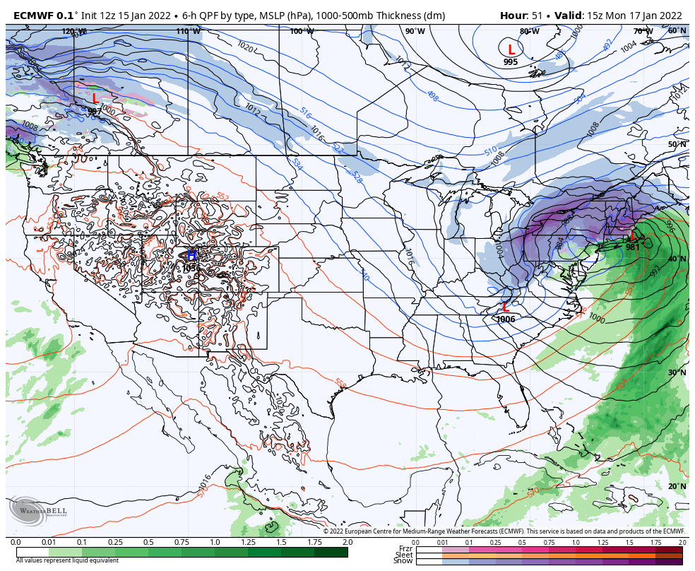
In the latest guidance, I’m noticing discrepancies, especially in ensembles, of precipitation field placement and low placement. The precipitation field around the low should have a certain look to it. When the average low placement is 100 miles to the west of the core of the precipitation field, I know we’re getting mismatched signals. That’s just one of a few items I’ve noticed in the latest guidance.
Upper air energy is hard enough to analyze and “see”; bringing in energy transfers and potential low deepening into the mix, and we’re really hinging on the model’s ability to understand the transfer (which is historically, not good).
So where does this leave us…
My snowfall totals take into account mixing from a more prominent inland low. There’s also lower snowfall amounts in the NE Kingdom of VT due to a dry slot forming between the two lows. Should the coastal low regain dominance, the mix factor diminishes and snowfall totals increase. I guess we could say the inland low totals are the conservative (Tony would be proud) approach – it can really only go up. And if they don’t, it’s still one of the larger snow events of the season, which I realize isn’t saying much for the season.
I’ll post the long term trends later, but I’m not going to send out an alert for it given the multiple blogs in a day.