We have a lot on the table for the holiday. weekend; another cold blast of arctic air and an impending low pressure system that a little temperamental.
This cold blast may not be as deep as the previous, but the timing is not helpful. We’ll have the heart of it in the Northeast Friday night into Saturday morning, but we’ve seen some recent moderation in the low temperatures (not as low) Friday night and high temperatures Saturday (slightly warmer). Good news into the weekend.
The other big talker, of course, is (potentially) the first major natural snow event of the season. There are a lot of interesting (and impactful) facets to this system. First, is the cold behind it. This is going to bring some high snowfall ratios to western PA, NY, even eastern OH and portions of WV. While the strongest part of the storm misses those locations, higher snow to liquid snowfall ratios will still bring some significant snowfall.
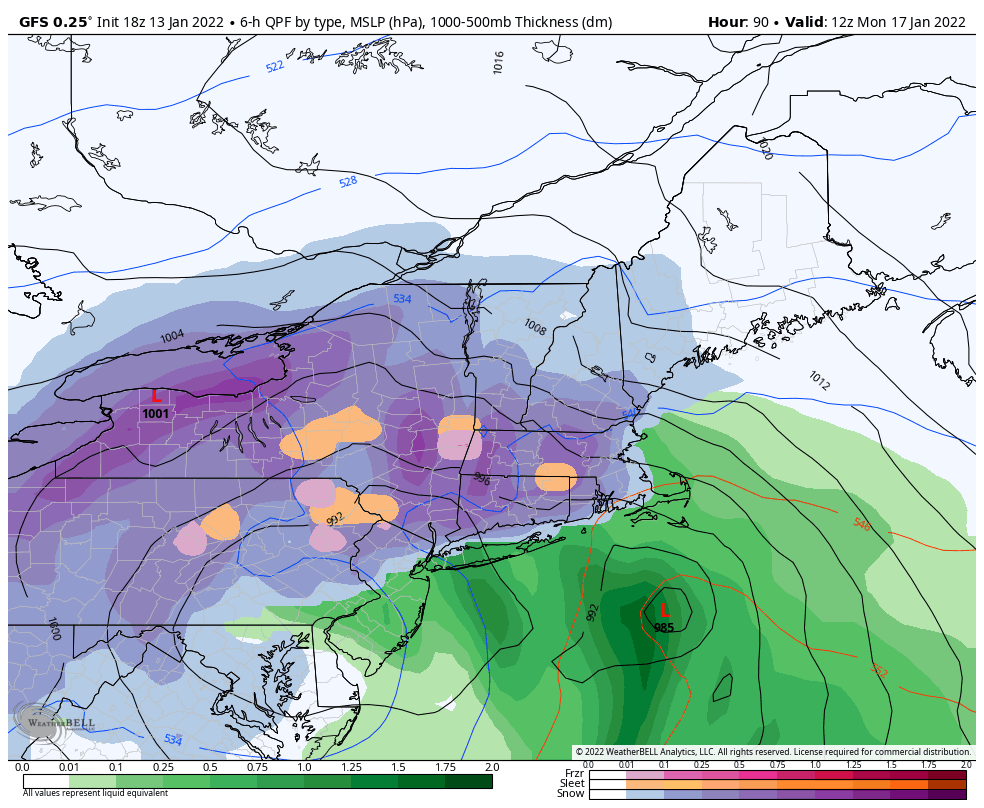
Second, there’s an interesting feature in the GFS model data that concerns me slightly – there’s a significant snow hole in the NE Kingdom of VT. This is telling that there’s going to be a dry slot in this storm, in addition to the role of two low pressure systems moving in tandem. As we saw with a previous storm, one low can steal energy from the other, and that may dramatically change the outcome of the storm. On the image shown, the two lows are shown. However, in the next frame, the western low over NY dissipates, and the coastal low takes over, but the precipitation field doesn’t respond as quickly. That’s while we’re seeing mixed precipitation popping up inland, and I’ve left that as a mention in the forecast discussions. Something to continue monitoring as we move closer to storm time…which is late Sunday evening through Monday.
Third, the wind; while the highest wind should stay out of ski areas, wind will pick up with this one more than normal given the “inside runner” pathway. Power outages are likely to affect the I-95 metro areas, up through coastal New England.