There’s not too much more to this week than the cold. Some of the lowest temperatures seen in the last 4-5 years will be rivaled in the next 48 hours. Pept0-pink is always exciting on snowfall maps, but not quite as welcomed on temperature maps. Wind Chill Warnings and Advisories are in place for much of New England and some of the Mid-Atlantic, citing dangerously cold temperature and wind speed combinations.
We’re already at -45 wind chill at the summit of Mount Washington at 3:00pm on Monday. Forecasts call for -45 to -35 wind chills for locations near the Canadian border at elevations of 2,000 feet and below. Those readings are likely to be lower at summits.
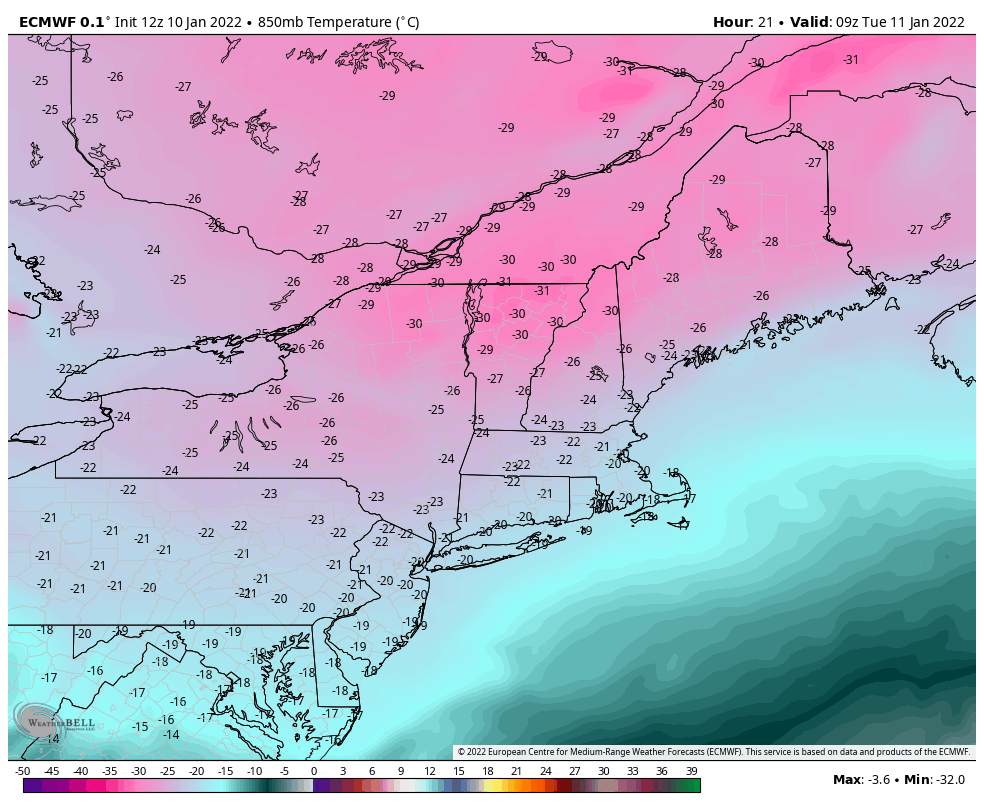
850mb temperatures will approach or surpass -30C (roughly -21F) Monday night in upstate NY, VT, NH and ME, and not much of a reprieve on Tuesday. This air mass will bring some of the most prolific snowmaking windows to the Mid-Atlantic seen all year and perhaps the last several years through Wednesday morning.
Though we’ll see rising temperatures at summits Tuesday night, though early inversions at base levels may yield a cold start to Wednesday morning.
The entire eastern half of the country remains rather quiet this week. Some snow showers on Thursday with a cold front is about all the precipitation-related excitement we’ll see. Arctic cold settles back in for MLK weekend.
There’s not much storm activity to speak of; there are hints of the pattern regenerating early next week, but we still have a bit of time to flush out those details.
Stay warm and safe out there!