It was a lackluster storm today, but it was something! Most areas received 1-3″ of very light and fluffy snow out of this system. We’ll see some upslope snow showers continue into the overnight hours in New England.
We have another weak system of mixed precip/light snow on Sunday before the arctic front comes through with snow squalls and snow showers into Monday.
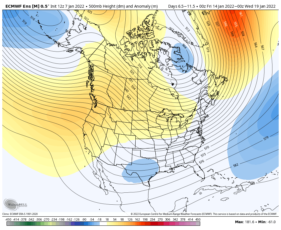
We have some good news going into the next couple of weeks – the cold is predominantly in place. Actually, for the Great Lakes region, I can only see two or three days in the next 16 that we hit the low 30’s. Mid-Atlantic states will have the most snowmaking opportunities that they may get all season long.
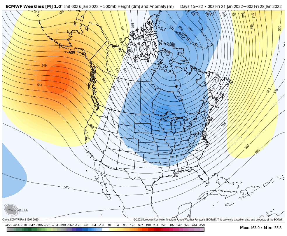
As we hinted to last week in this blog, the third week of January seemed a little split in the warm vs cold decision, with a clear view of warming into the end of the month and February.
Currently, the third week of January looks to stay relatively cold, with more consensus from both the Euro and GFS. The PNA (Pacific North American Oscillation) stays somewhat positive through January 20/21, which does help bring some better storm development and (hopefully) favorable track.
Cold snaps will continue through this time, though the arctic outbreak on Jan 10/11 should be strongest one of them all. Many areas in the New England will be below zero for 40-60 hours.
The inevitable warm up does look to arrive toward the end of the month. We’re entering into a period of extreme cold in the coming week, and numerous cold blasts following, and eventually, we have to rebound the other way (the atmosphere strives for equilibrium). Currently, the last few days of January and the first week or two of February will feature an eastern ridge. Now, this doesn’t mean we’ll be blowtorch hot, but cold bursts may be harder to come by, and natural snow would be a toss up depending on where the NAO/AO land.