The cold is here and it will settle in deeper Monday night – we see some of the longest and deepest snowmaking windows for the season so far in the Mid-Atlantic. We’ll see a cold start to Tuesday with the sun making a reappearance as well in the east, and a brief warmup ahead of a front in the Great Lakes.
The Northeast warms up (briefly) Wednesday ahead of that same front, before it comes through Wednesday night. We’ll have a weak area of energy move along it, but it doesn’t ride along the boundary until it’s almost through New England. Therefore it’ll only be impactful to southern NY, MA, NH and ME into Wednesday evening with some rain/snow showers, or a light mix.
We cool back down on Thursday before the biggest topic of discussion comes into the forecast: a possible nor’easter for Friday. There’s been quite a bit of discrepancy (surprise surprise) with this one from the Euro and GFS. The GFS had this storm about 4 days ago, and then dropped it off. It’s not uncommon for the GFS to do this in its “old ways”, however recently it has been doing really well in the medium range. Whether that was only in the SE ridge pattern (which was very hard for all models to grasp) or it’s an overall change, is too soon to tell because we haven’t been out of the previous pattern long enough. Friday’s system is somewhat of the true test.
The overall difference is a lack of phasing of two energies in the Midwest. I plan to do a video on this tomorrow, because it’s a bit hard to show without numerous images and animation. However, ultimately, the Euro and Canadian have a successful phase of energy in the Tennessee Valley, causing the energy to dig into the Mid-Atlantic and resulting coastal low to form. The deterministic GFS and newest NAM run do not phase successfully, bringing about next to nothing to the area. However, the GFS Ensemble clearly has a coastal system, therefore my hunch is that the GFS is back to its old ways. The million dollar question becomes the phasing, and then even moreso; the timing and location of that phasing, which ultimately determines the location of the coastal low and its trajectory up the east coast.
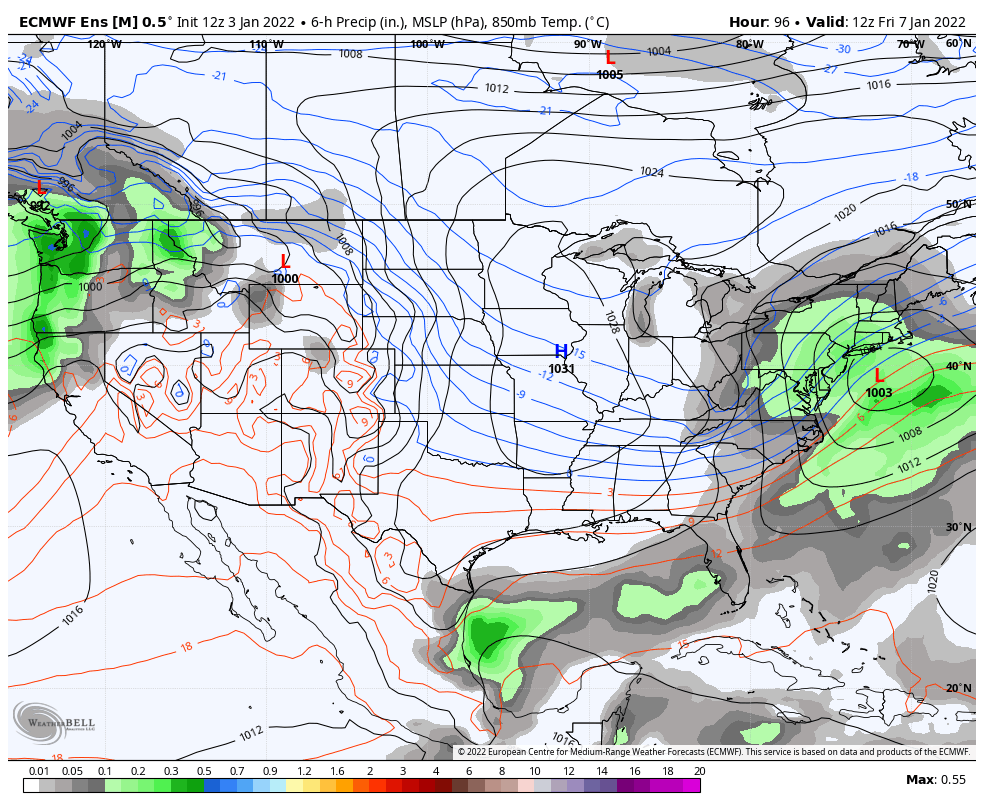
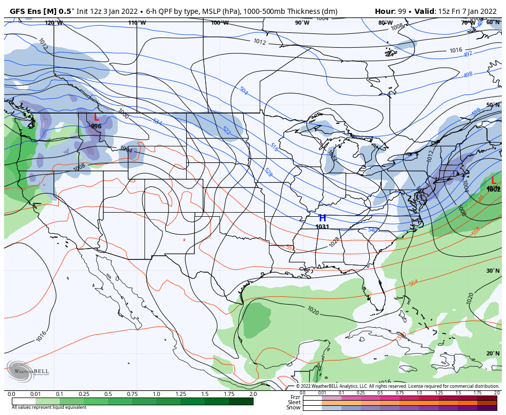
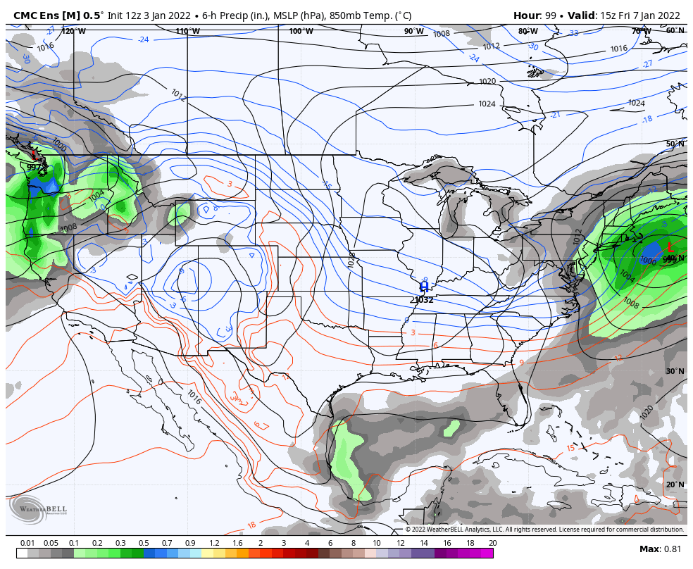
The three images are the GFS, Euro and Canadian Ensembles for 7am Friday. The Euro is a little slower than the Canadian/GFS, therefore the system looks less amplified.
Behind this, Saturday certainly looks cold. Another system approaches for Sunday from the Great Lakes (where it stays cold), but the result of Friday’s storm will likely alter the solution for Sunday’s system, so I’m not going to get too heavily detailed in that just yet. It’s possible we see a similar warm up to what we’ll see Wednesday, or we may just sneak by with slightly less cold temperatures. Rain and snow showers can be expected in the Northeast.