I wanted to provide a brief update on the incoming snowmaking windows given the lack of cooperative weather we’ve had, and the expected rain this weekend.
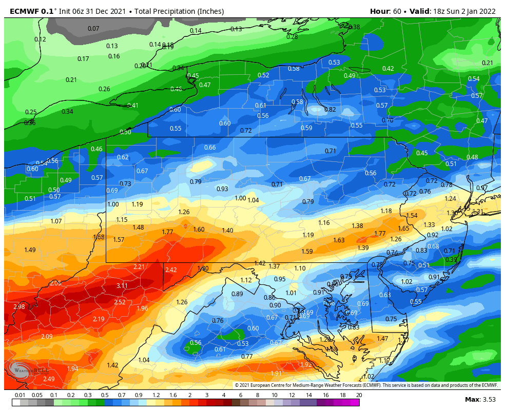
Showers move in on Saturday with heavier rain expected Saturday night into Sunday morning. Total rainfall amounts may exceed one inch, depending on the exact track of the lows. There are still some finer details to work out with the track.
Behind the system, temperatures crash into Sunday night, but the windows probably don’t open up until the pre-dawn hours on Monday. Temperatures Monday likely bump slightly above freezing at the base but only for a couple hours (wet-bulbs will be in range with low humidity levels). A strong window returns Monday night into Tuesday morning.
Tuesday we’ll have temperatures that rise into the upper 30’s, but with initially clear skies Tuesday evening, we may have a brief window, especially at the base where we can briefly invert. Clouds move in overnight into Wednesday morning, but the SSE flow may keep an inversion in place (especially Liberty).
We’re warm Wednesday into Thursday, but it looks like we should have another crash of temperatures Thursday night, which should open up more windows next Friday and the early weekend.