
Happy New Year everyone! We’re taking a look into the first couple weeks of January. While it’s not the most ideal overall pattern for the east, it’s one of the most favorable for since we entered the late fall/early winter season.
The Euro has not been performing well with this pattern and the winter as a whole, so I hesitate even posting much from it, but I wanted to show a comparison. You’ll see the Euro Weeklies anomaly for 1/7-1/14 and then the GFS for the same time period. Notice that the GFS is much colder, which is expected against the Euro.
With a positive PNA pattern emerging around 1/10 (even from the Euro), a stronger eastern trough should be expected for the second week of the month (The PNA is the Pacific North American Oscillation; negative usually indicates a western trough, positive is the eastern trough. It has been very negative over the last couple of weeks).
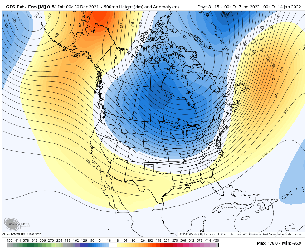
Though the GFS is stronger with the trough and incoming cold, my hunch is that the trough will be centered a little farther east than what it’s shown as in the Extended model. This should open up snowmaking windows and allow for cold air intrusions for everyone; Great Lakes, Mid-Atlantic and New England.
The Arctic Oscillation (AO) and North Atlantic Oscillation (NAO) both stay positive in this time, which signifies we’re not expecting arctic outbreaks or any major blocking patterns during this time. It’s both good and bad; sometimes strong blocking (highly negative NAO) or intrusions of the polar vortex (highly negative AO) can shunt storms well to our south, which means little to no natural snow.
However, no blocking can allow warm air to intrude when storms arrive. Neither the NAO or AO look overwhelmingly positive (near neutral or around 1), so I think it’s a good sign for natural snow for the first two weeks of the month.
Heading into MLK weekend and beyond, the models begin to diverge. The GFS energizes the trough over northern Ontario/Hudson Bay, while the Euro tries to re-engage the SE ridge.

The Canadian is on the same page as the GFS, along with the CFSv2. Given the current strength of the GFS this winter, I’m going to lean toward the colder solution.
However, there is consensus in all models that we begin to see that eastern (or southeastern ridge) emerge into the end of January and February. Obviously that’s a month away, but perhaps we can chalk that up to a possible late January/early February thaw.