I wanted to provide a quick update to following the discussion on this system in the Monday blog. As expected, models have had a terrible time distinguishing features in this system. With the multiple lows and upper air interactions, it’s been quite a mess to analyze.
However, also as we discussed, it would be on Thursday that we begin to see some transitions. There are still a couple inconsistencies and we’re just starting to see some more consensus on items, but still too early for finer details.
A few thoughts:
~ The GFS has particularly handled this SE ridge pattern well with features cresting the ridge
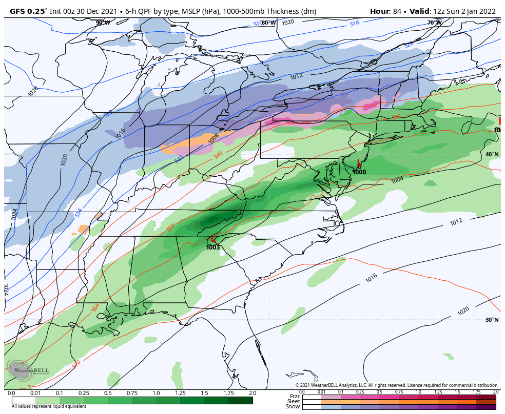
~ We’ve continually see a one-two punch system portrayed in the GFS, and as we spoke about, one low is stealing the thunder (the second one)
~The colder solution returned to the GFS yesterday in only the 0/12z runs, which tells me there’s an upper air feature that’s a major player in this
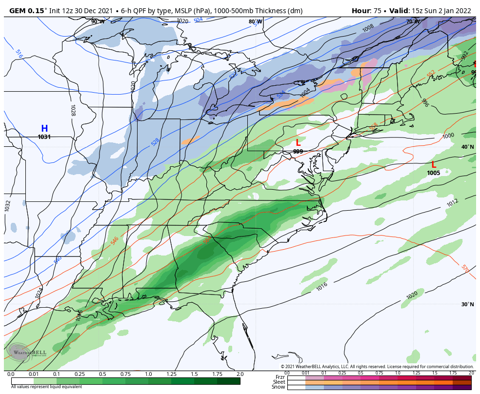
~Canadian began shifting more toward a colder, second-low solution in the 12z run, but still on the warmer end
~NAM made a huge shift in the 18z run
~Euro still out to lunch
While we may be seeing a colder solution, but that doesn’t mean everyone’s going to escape the rainfall. I’ll post the solutions from 0z GFS (from last night), 12z Canadian, and 18z NAM below. The 6z GFS went warm (not surprising without the upper air data), and the 12z GFS split the difference. When models are doing this, they are typically in the trend/transition phase, which is tricky to begin making a forecast, as it’s usually another 12-24 hours of model runs for them to be able to resolve the transition. I’m hopeful we’ll see the finer details by Friday afternoon.
My hunch is northern NY/VT/NH/ME see mostly snow out of the second low of the storm, and it’s possible that translates south to central NY/VT/NH/ME depending on how the upper air feature interacts with the overall system. At this time… PA, MA, and southern NY/VT/NH/ME have much lower chances of escaping the rain.
Update – 18z GFS in with a very similar solution to the 0z from yesterday.