We’ve been keeping close tabs on this Christmas storm system for quite some time now. The SE ridge has had a significant impact on storm tracks and models seem to be confused by storm progression, strength, and overall structure of systems moving overtop the ridge into the Atlantic.
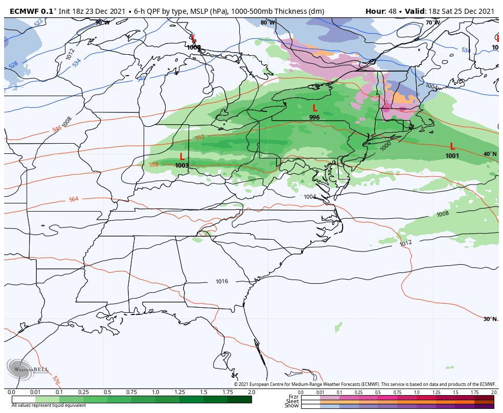
By Christmas afternoon, the showers have moved out of the Great Lakes and into the Mid-Atlantic. The cold air mass now currently in the Northeast is being nudged out without a blocking high pressure in Canada, despite having a negative NAO (shows us that it really does take until later on in the winter for the NAO to truly show its influence on our pattern).
Some mixed precipitation and rain showers can be expected in New York State, from the Catskills into the Adirondacks. We’ll see a messy mix for the last half of the day Christmas in MA/VT/NH and the best chance of snow is in Maine.
At this point, we have a larger overall discrepancy for New England, and whether or not we have a secondary coastal low generation offshore of Cape Cod Sunday morning. If developed (and close enough to the shore), a moderate snowfall is possible. There’s still a fair amount of discrepancy on this outcome, so we’ll touch on it more Friday before our long-term views when we should have a little more information on its development.