With this progressive pattern into the holiday weekend, we’re seeing wild movements in temperatures as air masses quickly move in and out of regions, which means a continuation of non-diurnal temperature patterns with rising overnight temperatures and falling daytime temperatures becoming commonplace through Thursday.
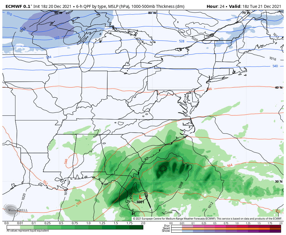
We’ll have two low pressure systems moving through the eastern half of the country on Tuesday. An Alberta Clipper moves through the Great Lakes with some light snowfall, and a coastal low begins moving up the east coast. Some of the rain skirts the Mid-Atlantic coast, but for the most part, the precipitation stays offshore.
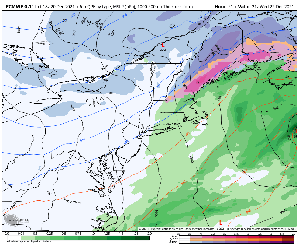
The two lows begin to interact as they move east and northeast respectively. The phasing of the two lows doesn’t occur until well beyond the optimal time, which only leaves light precipitation for New England, and mostly for Maine and some of New Hampshire. Inland areas receive a light snow, while freezing rain may mix in closer to the coast on Wednesday.
Another blast of cold air settles into the eastern half of the country for Thursday. A weak shortwave provides some light snow through the Great Lakes on Thursday, and moves into the Northeast, mostly southern New England on Friday.
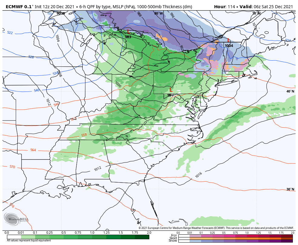
Perhaps the second most talked about feature of this week is the Christmas system that is brewing for the region heading into Friday and Saturday.
Coming into the Great Lakes as a warmer low pressure on Friday, the warm front begins nudging into the Northeast by late Christmas Eve. A strong Canadian high pressure (negative NAO) provides some resistance, and this keeps more snow in New England, but not enough strength to keep it cold enough for snow in all of the Northeast.
Mixed precipitation may be prevalent across NY, NH, MA, VT and ME depending on how much of the cold air can stay in the area.
The NAO is significantly negative, so I’m internally hedging toward an even colder solution than what we are seeing in the Euro 12z run. Usually in these scenarios, the negative NAO (and subsequent blocking) shunt storms to the south, which was the concern conveyed in the long term blogs last week.
However, we’re still early in the season for when the NAO/AO are big players in the forecast, so we may be in the sweet spot of being able to sneak in storms with strongly negative NAO situations. I’ll continue to update on this one.
Cold air is reinforced on Sunday with some lingering snow showers, especially in the favored upslope areas of the Adirondacks and Greens. The week leading up to New Years weekend looks very similar to this week with Wednesday & Saturday storm systems. The pattern remains cool overall but we may still see some ebbs and flows with relatively mild days here and there.