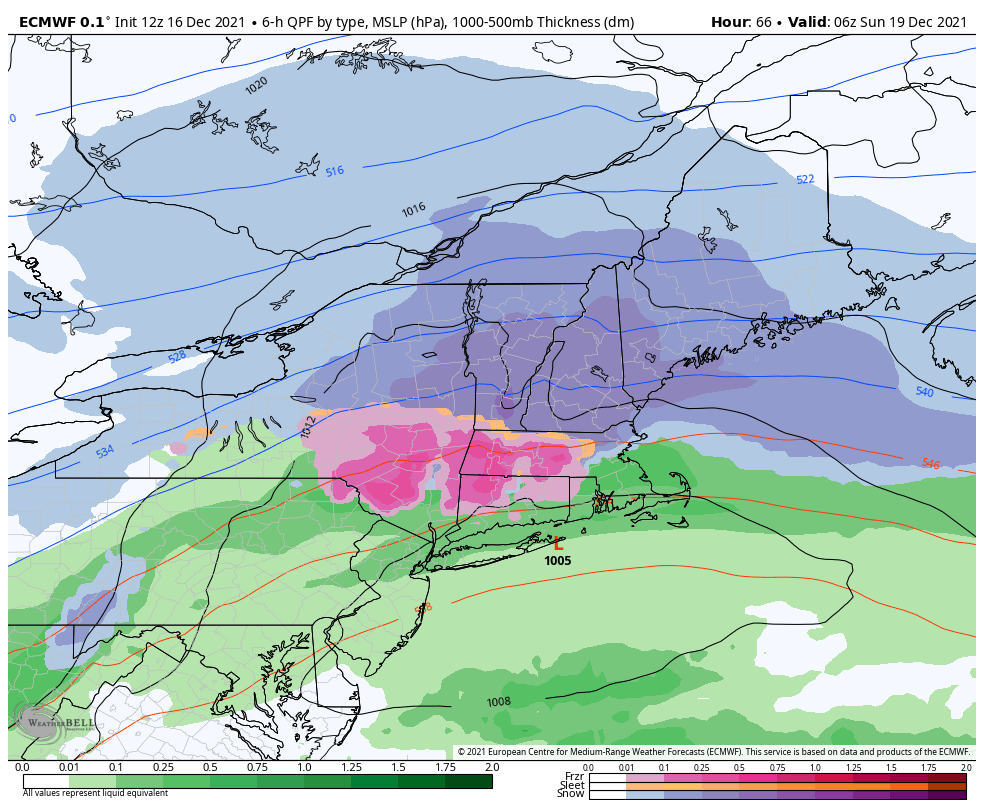
We have our first major snow of the season for the east as a low pressure rides along the stalled front that moves through tonight.
While we’re still waiting for our first major snow, this will have to do to get us through Christmas week (although there are some other storms to come before Christmas).
I’m still a little concerned for mixing at Mount Snow – not to say there won’t be significant accumulating snowfall, but it may change at the height of the storm, which ultimately limits snowfall. High confidence in 3-6″, but much lower confidence to go 6″+ for Mount Snow.
Attitash and Wildcat will be the winners as there’s no mixing concerns and ratios will be far more favorable the farther north you go. Actually Wildcat isn’t far from the 15:1 ratio line. With ~.70″ of liquid falling in this system, we’re looking at an average snowfall of about 10″ at Wildcat, probably closer to 8″ at Attitash
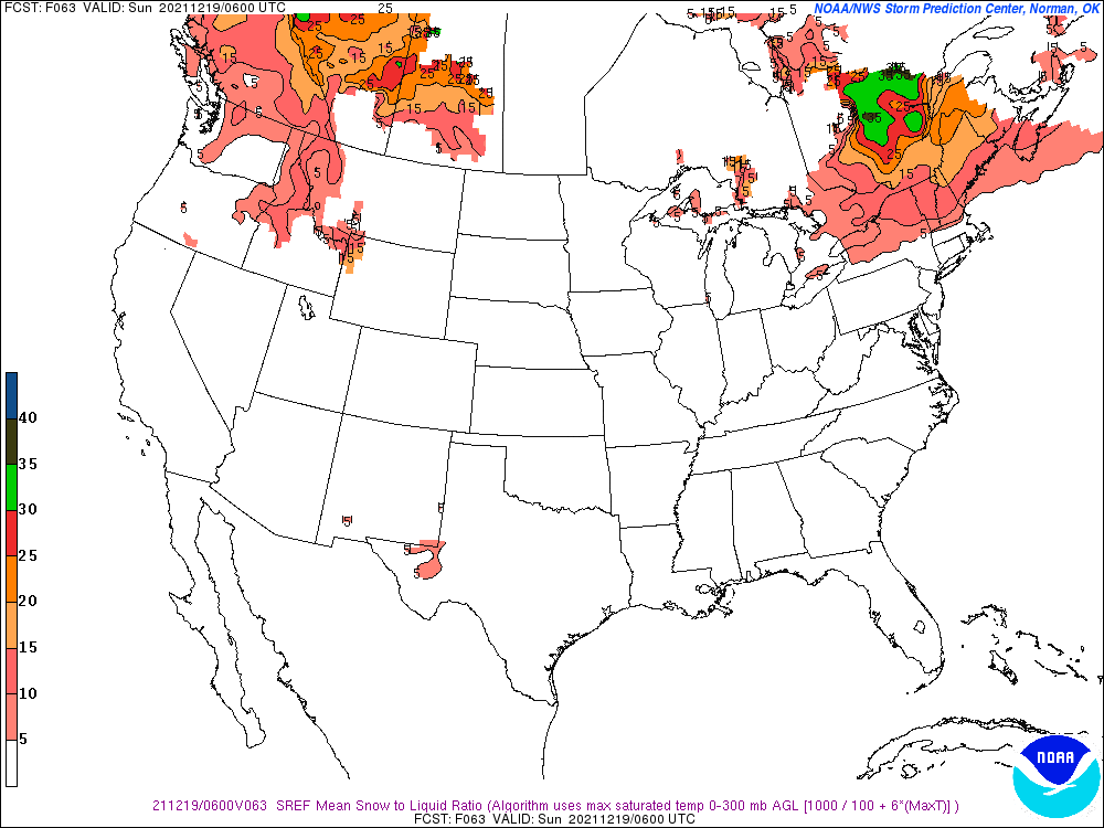
Back to Mount Snow for a second; notice that the ratio is near 5:1; another sign mixing with sleet may be inevitable.
Hunter will see minimal snow, 1-2″ likely, slight chance 3″ before we mix with sleet and freezing rain, and may ultimately change to rain very briefly before the cold comes rushing back in.
Mid-Atlantic areas will see rain only out of this particular system. Behind the storm we will have a substantial cool down which may open up some snowmaking windows for our Pennsylvania resorts.