We’re somewhat back into the pattern we left last winter in – we get the cold but we can’t keep it when a storm comes. A strong cold front has been making its way through the east today…leaving snow showers in its wake from the Great Lakes to New England.
Tuesday will be a cold day all around, though wind won’t be as much of an issue as its been in the past with strong fronts.
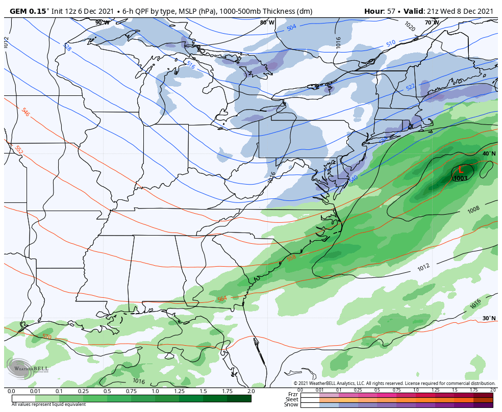
A weak wave of energy finds itself a coastal low to merge with, but just a touch too late for a memorable storm – therefore it’s about 200 miles too far offshore. It spreads light snow across most of the Northeast on Wednesday, with some amplification along the Mid-Atlantic and New England coasts.
However, behind the missed-opportunity coastal low, we get another blast of cold air into Thursday and early Friday, before another inside runner sets up for the weekend. This will warm us up significantly into Saturday, and another low pressure/strong cold front comes through early Sunday morning. Expect another crash of temperatures Sunday night into Monday.