Teleconnections refer to recurring and persistent, large-scale patterns of pressure and circulation anomalies that span vast geographical areas. The most well-known one is ENSO – El Niño Southern Oscillation. While ENSO doesn’t have a major say on the east coast weather pattern, other teleconnections do tell a bit of the story. We have a weak La Niña this year, but there’s no direct correlation between snow and ENSO cycles, except that strong El Niño’s/La Niña’s are typically not fruitful for us in terms of snow.
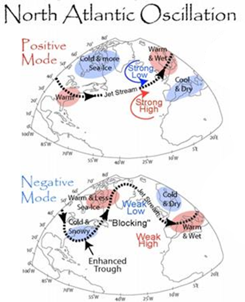
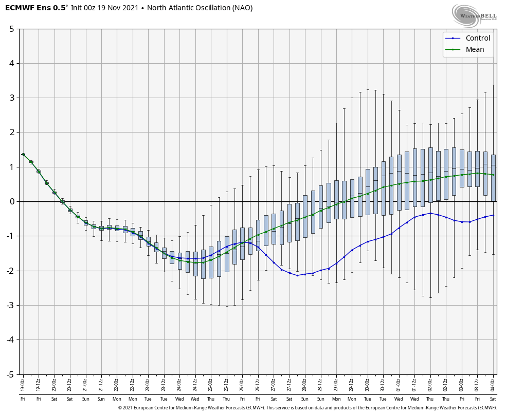
The ones we speak about the most during the winter are the AO & NAO, (Arctic Oscillation and North Atlantic Oscillation). Those oscillations are measures of the availability of sustained arctic air (think polar vortex – that’s the AO) and the ability to block/sustain it (that’s the NAO – it measures the strength of the Icelandic high/Azores low) – which go hand in hand for cold and snow. The phases of the NAO are the same pattern for the AO, so you can relate this image to both oscillations. Overall, negative is good for snow and cold.
When we see up & down movements between positive and negative in teleconnections, it typically signifies pattern changes. Inflection points (peaks & troughs) are highly correlated with storms. Teleconnections aren’t well forecast more than a week or two out, because it depends on the model data. Whereas ENSO we can project far into the future, the NAO/AO have about the same accuracy in the long term as your normal forecast.
Beyond the NAO/AO, there’s the EPO, WPO, and PNA that we look at. We’ll touch on those in another blog this week!