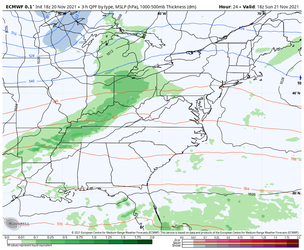
We’ve had our eyes on this system for quite some time now, with the beginnings on Sunday starting in the Great Lakes; light rain/snow is expected.
By 10pm Sunday we have light precipitation overspreading the area but temperatures look to be colder than previously expected. This is likely due to the intrusion of cold air coming in from Canada and the blocking pattern that is briefly setting up. The cold air moves through New York state by sunrise Monday and all the way to Downeast Maine by sunset.
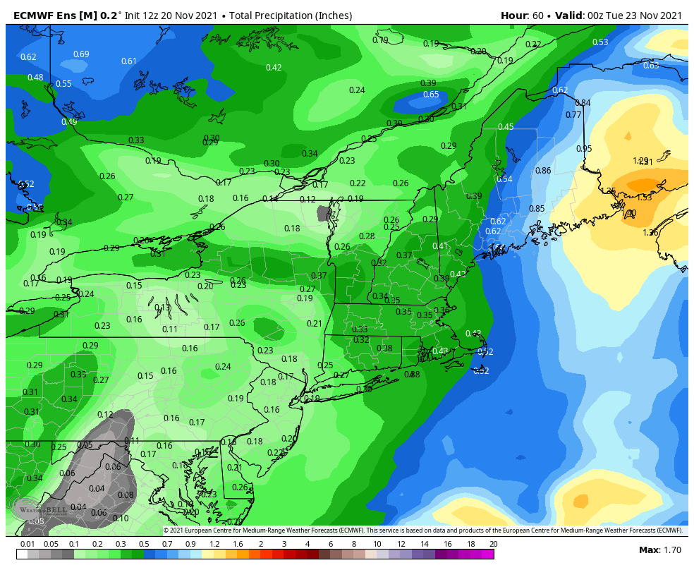
Total precipitation has come down in the European ensembles, and the higher elevations will actually pick up some snow as well. Widespread .30-.50″ and possible 1-2″ on summits (excluding backside snow showers after the front comes through).
Certainly a better scenario than what we were looking at a couple days ago.