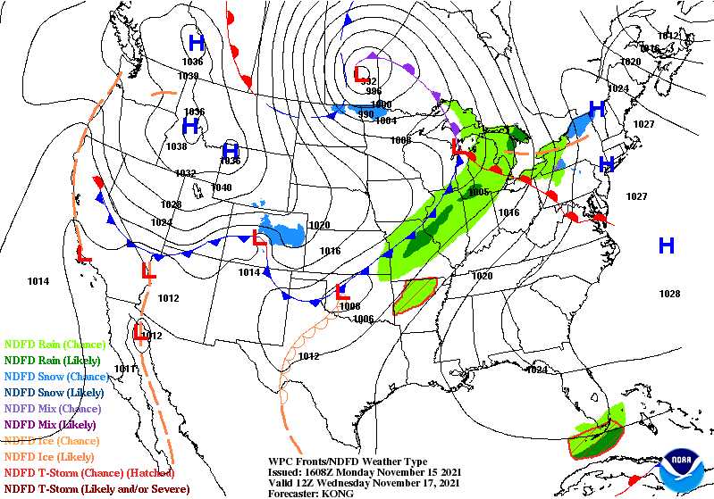
The first significant round of cold continues to settle in Monday over the Great Lakes, with the coldest part of the air mass over the Northeast later Monday into Tuesday. It will gradually retreat into Wednesday, from southwest to northeast as a warm front approaches from the south.
We may see some cold air damming setup in the east on Wednesday, as evidenced by the small kink in the warm front over the Shenandoah Valley, and the very clear dominant high pressure over New England. Therefore while the cold retreats, I don’t expect New England to get “warm” on Wednesday. The Mid-Atlantic will certainly warm up, and the Great Lakes stays somewhat stagnant in temperature given the path of the low.
Thursday is another story. While cooling occurs in the Great Lakes, the Northeast will be in the warm sector of the low pressure moving across the country. Expect highs in the 60’s in the Mid-Atlantic, 50’s through the Hudson Valley and southern New England (possibly all of New England depending on how much sunshine we get), and certainly widespread 40’s in New England from base to summit.
This a pretty strong front, with the coldest air of the season (stronger than what we’ll see on Mon/Tues night), leading to quite a breezy Friday, with the Great Lakes cooling down fast, and that cold air surging east.
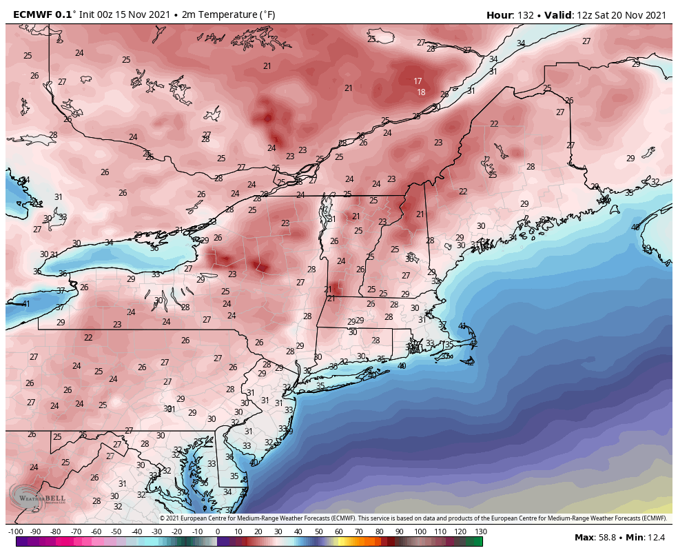
The cold entrenches itself pretty good by Saturday morning in the Northeast. Take a look at surface (2 meter temperatures) for 7am 11/20. Sunday we’ll see some moderation, but that all depends on a low pressure system that’s dancing around the east by early next week. It is too soon to see details in it, however the holiday week looks active. Based on ensembles, there are three low pressure systems to impact the Great Lakes/Northeast from Monday to Sunday of the Thanksgiving week. We’re certainly making up for the very quiet, temperate, and enjoyable weather we saw for the majority of fall thus far.