
The majority of this week is spent waiting for the colder air mass which is scheduled to arrive this weekend. There are a few discrepancies on timing and initial depth but we’ll start to see some of those details come into light as we get closer.
Overall Monday and Tuesday are warm days – probably the warmest days we’ll have for quite some time. By the end of daylight hours Tuesday, temperatures in the high elevations of New England will start moving downward with a weak cold front and attending low pressure moving through. This shortwave brings mostly showers, but some snowflakes may mix in.
A brief period of cold for the highest elevations in northern New England could allow for a 6-8 hour period to run the guns Wednesday night – otherwise it’s back to warmer temperatures Thursday, but not nearly as warm as Monday/Tuesday.
By Friday, our approaching (stronger) cold front arrives with warmer air, rain and wind for the majority of the day. The front slows forward progress Saturday until a secondary weak cold front has the final punch of cold air coming along with it.
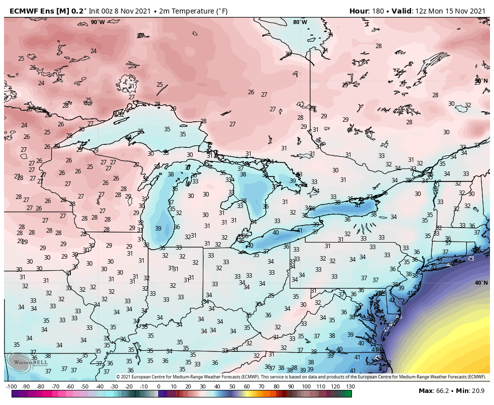
Cold continues to settle in Sunday with surface (2 meter) temperatures in the low to mid 30’s across the Northeast, Mid-Atlantic and Great Lakes by Monday morning.
What’s also noticeable Monday morning is the colder air lurking in the western Great Lakes. That insinuates we have a third cold punch to eventually come in, but we’ll take a closer look at that on Friday in our long term views.