This was our season changing week with not one, but two coastal lows to impact the east coast. The tropics look all but shut-off (minus the invest of what impacted us Tuesday/Wednesday), and we have our first cold shot of the season next week.

Though we’ll be at the mercy of the current pattern of coastal storm generation, the cold coming in next week may be our best sustained cold until the first of several holiday weeks. The cold, which looks to peak next Thursday morning, retreats heading into next weekend – operational models have also been toying with a coastal low generating next weekend too.
While models notoriously have trouble seeing long term cold, given the biases of globally warming temperatures, it does look like we may have at least a week, if not longer between the retreat of this initial first long-term batch of cold, and the next one to come in.
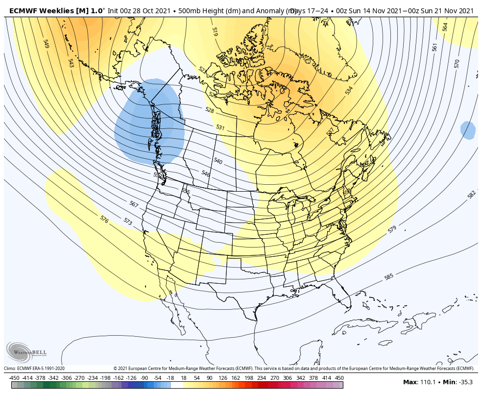
Heading into Thanksgiving week, there are indications of cooler air returning, but how deep or sustained that is, is still a little far to be seen. By the end of the month, we should theoretically be seeing some impacts from the stratospheric warming event that occurred in the last few days.
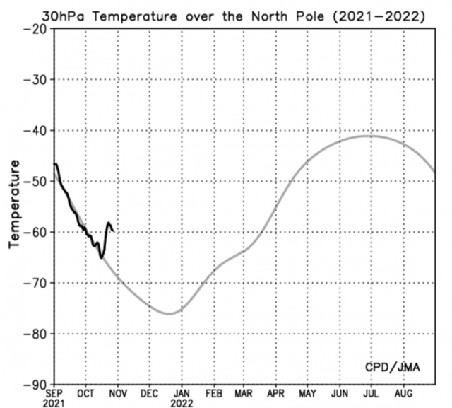
The graphic above showing the sudden stratospheric warming event occurring – which tend to trigger a weakening of the polar vortex. The weakening of the polar vortex allows arctic air to leave the polar regions and move southward, which is when we usually hear about it in the news, and we receive abnormally cold air.