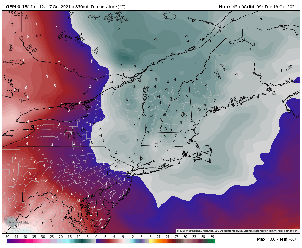
The cold front came through with heavy rain and even some thunderstorms last night, but the cooler air slowly sets in now with the first proper cold shot of the season. An upper-level low overhead reinforces clouds and even rain/snow showers for Monday and Tuesday, allowing that cold air to truly settle in. Temperatures drop to (or slightly below) the freezing mark in elevations >3,500 feet tonight, but the coldest night will be Monday night. Despite the clouds and even light rain/snow showers, the core of the cold air mass settles in after midnight Tuesday morning. Not surprisingly, the Euro is the least robust with the incoming cold. I’m venturing a little closer to the Canadian depiction; the model usually has a good handle on cold features, and the Euro is notoriously warm more often than not. The NAM gets excited with some brief outputs of -6C in north-central Vermont, and the GFS not far behind. It’s not uncommon for first cold shot to be overdone by models given we’re venturing into more unseasonable numbers, and models have a bias towards that.
That being said, bases are unlikely to hit the freezing mark with this cold wave – more likely for elevations of 2,500 feet and up in New England. Also note this will be brief – the core of the cold settles in before sunrise Tuesday but starts retreating west to east by Tuesday afternoon. Our next cold hit looks to arrive Friday and has the potential to be deeper, longer, and more geographically widespread than the one early this week.