For the past couple of weeks, we’ve been highlighting the necessity of the tropics to shut down before we can get cold shots in and try to sustain it for any reasonable amount of time. There’s one disturbance in the middle of the Atlantic meandering around with a 0% chance of formation in the next five days, per the National Hurricane Center. While we certainly can get tropical systems in October, there’s not much to work with right now. It’s possible that energy gets wrapped up in a cold front next week, which will have to be watched closely.
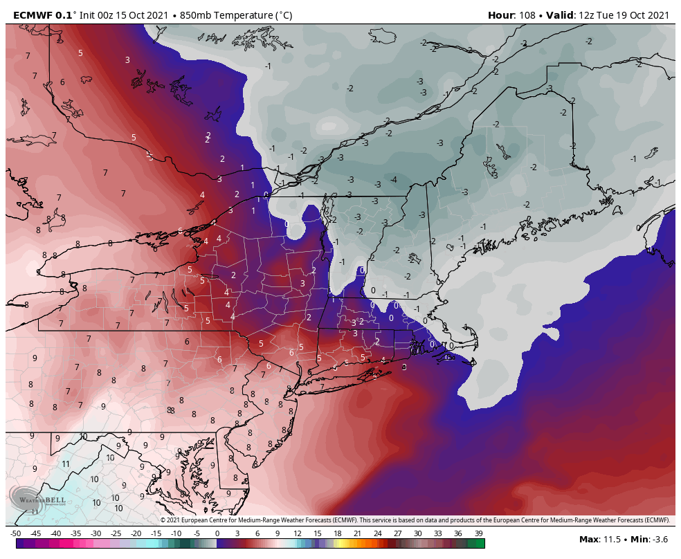
Our first shot of cold air comes in this weekend, in part due to the quiet tropics, and it may be cool enough for some brief snowmaking or at least testing in most of New England for elevations > 3,500 feet, most notably on Monday night into Tuesday morning. The GFS is a little more robust with the cold than the Euro, but it should be enough to get higher elevation guns on for a minimum, a good test. Though it won’t be to this week’s level, we will warm again into the end of next week before another potent cold front comes through next Saturday (10/23), and this one may have more legs to stand on.
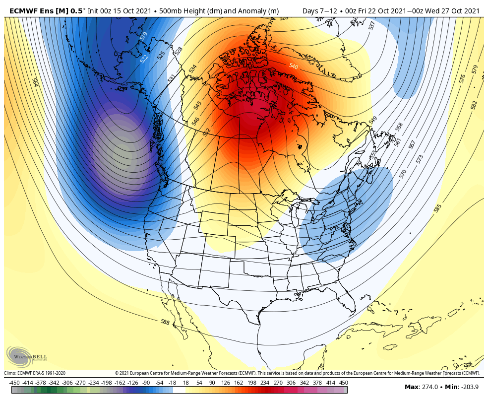
Taking a look at the Euro Ensemble of the 500mb height anomaly, we can see the anomalously high heights near Greenland and the subsequent trough along the east and Gulf of Alaska (we often look at these visuals to get a broad overview of the atmospheric pattern at around 20,000 feet).
This structure doesn’t move for some time and can be referred to as an Omega block (if you draw a line underneath the western trough, to the top of the ridge, and back under the eastern trough, it looks like the Greek letter omega). The positioning of this block is somewhat favorable and could set us up for some consistent snowmaking windows for the last week of the month. Days 10-15 have the same features/outlines as well.
Overall, we’re starting to see the cold shots thanks to the Atlantic tropical season cooling its jets. Given climatological norms, we don’t have much time for the tropics to continue churning out storms. With this lull, cooler air moves south, ocean temperatures cool more rapidly, and even if something tried to form, it likely wouldn’t be sustainable. Therefore despite going this long without hard freezes and frosts, I think that’s coming to an end as we get the last few days of the month, if not sooner.