There’s still not much excitement for the long range right now, but the good news is that we’re not seeing any major warmth on the horizon either.
Cool air returns this weekend and next week we’ll have another repeat of the middle of this week; highs in the 60’s and maybe a 70 or two, but no major heat builds. We’re also starting to see some signs of the October warmth breaking down, and subsequently ending our dry pattern as well.
It will take some time though; I’m looking at 10-14 days out right now for the earliest possible shift to the cooler pattern or any bouts of significant cold in the East, and more likely we’ll have to wait until November for anything prolonged.
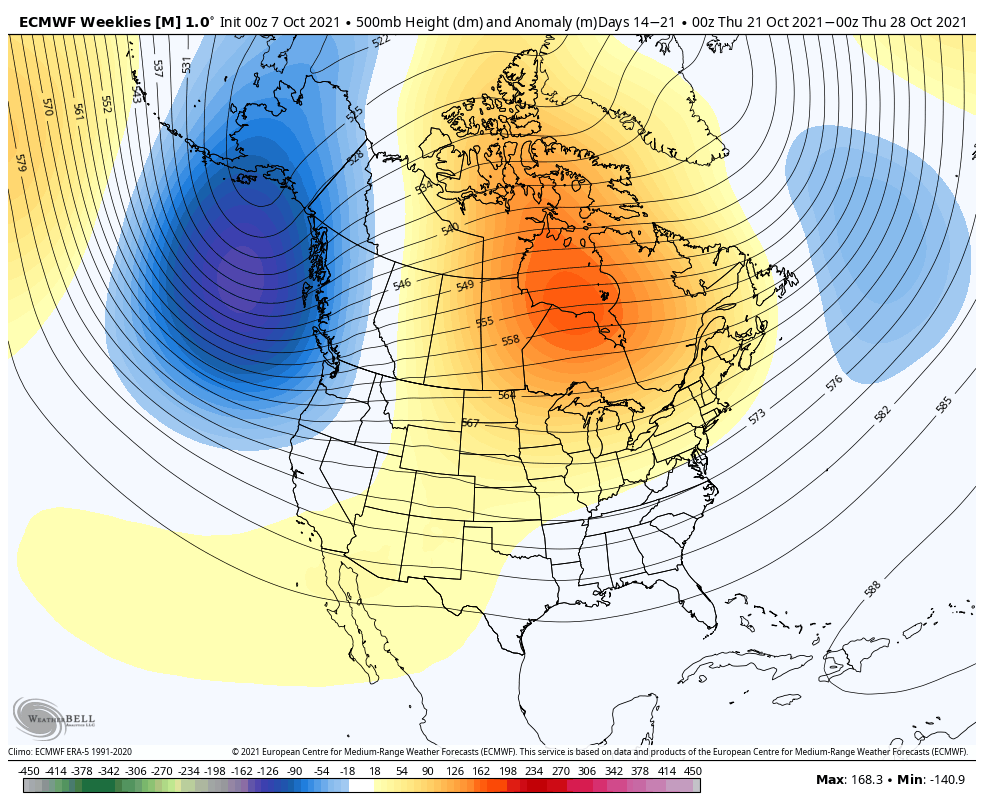
Here’s a look at the Euro Weeklies for 10/21-10/28. Key pieces to notice; troughing trying to dig off the east coast (blue area), increasing heights (ridging, red color) in central Canada, and neutral (or no anomaly) in the southeast. The weakening ridging on the east and trouhging over the north Atlantic should allow some troughing to begin developing in the east, with some colder air punches beginning to come in from the west.
Nonetheless, it all comes down to the tropics. If the tropics remain heated and active, these cold punches will be less amplified as the troughing off the east will be shunted north.
Have a great weekend and I’ll catch you here on Monday.