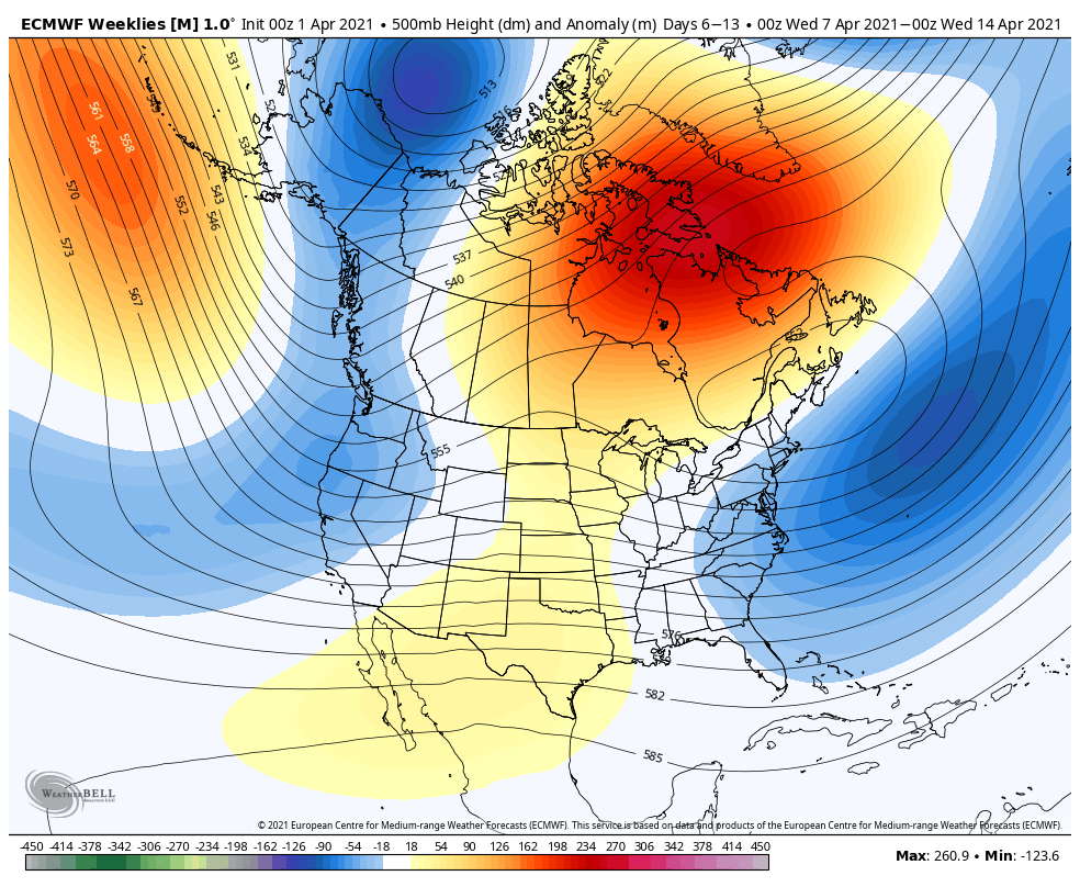
Last week we touched on the alignment of the thickness lines being conducive for some back door cold fronts or pieces of energy coming in from the east (retrograding energies). That has indeed come to fruition for next week and may impact the entire weather pattern due to some overall “lack of flow” aloft. What leads me to this possibility is the noticeable, oddly stagnant NAO/AO in the long range.
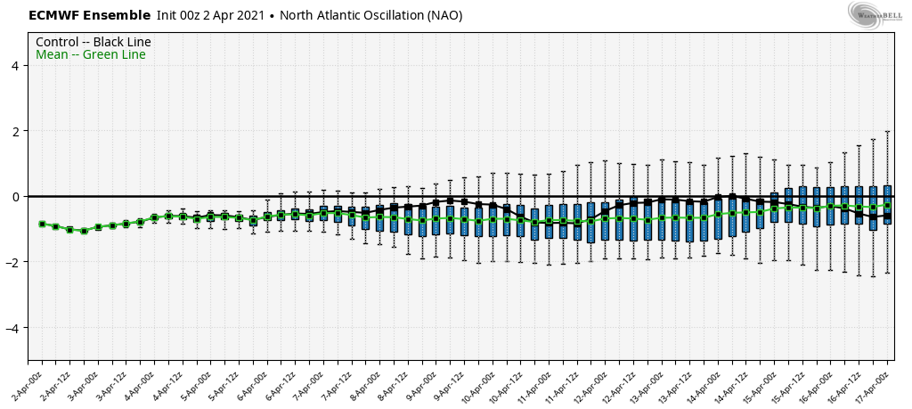

Usually when looking out in time, there are some wild swings because of the different ensemble members. However, this is abnormally quiet-looking, especially in a time when we can still see a bit of volatility for seasonal transition. The PNA turns positive around 4/13, which may start to amplify the pattern more, but we’re not seeing much feedback here in the AO/NAO through 4/15. What looks to be developing is an Omega block. An omega block gets its name because it looks like the greek letter Omega – a trough on the west coast, ridge in the central US, and a trough on the east coast. These are notorious in the spring for very cloudy, dreary weather patterns that prevent the sun from shining for days in the Northeast, and depending on orientation & depth, can affect the Mid-Atlantic, Great Lakes and Ohio Valley too. The lack of flow aloft can also “trap” weak low pressure systems, or upper level lows, leading to continued cloudiness and unsettled weather. Both models have signs of this heading into the mid-month. It was at mid-month I anticipated a turn toward more “transitioning to spring” conditions, however blocking is always something that can disrupt long-term anticipated trends. Omega blocks tend to favor back-door cold fronts and retrograding low pressure systems in the east because the atmospheric flow is “blocked” from the west.
Our first retrograding system arrives Monday-Tuesday next week and sticks around through Thursday. Light snow/snow can be expected in this time period, favoring ME/NH a bit more than southern New England and the Mid-Atlantic. The Euro is hinting at a second one possible next weekend, around 4/12, which is around when the PNA should be picking up and getting the pattern out of this block/traffic jam. However, both models do keep a slight trough in the east through the second half of the month too – which means we may not be seeing a true spring transition until later on in April.