We have two significant systems moving through the eastern half of the country over the next 4 days.
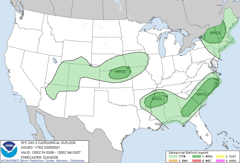
Clouds departed earlier than expected today, allowing for more warmth and destabilization to set up in the Northeast. The approaching cold front will bring rain and even thunderstorms to the area Friday. Storms have been outlined in forecasts for several days now, though northern & central NY, VT and NH, western Maine and western MA are in a marginal risk for severe storms per the Storm Prediction Center. Isolated damaging wind gusts along with an isolated tornado are possible in these areas during the afternoon. Precipitation amounts will range from <.25″ in the Mid-Atlantic, .25-.50″ in southern New England and .50-80″ in northern New England.
Behind the front, expect snow showers in the typical upslope snow areas. A couple inches are possible as temperature crash and wind stays elevated.
Wind remains elevated Friday night but subside Saturday morning. Overall Saturday will be a quiet day with temperatures cooler, but still above freezing at base levels.
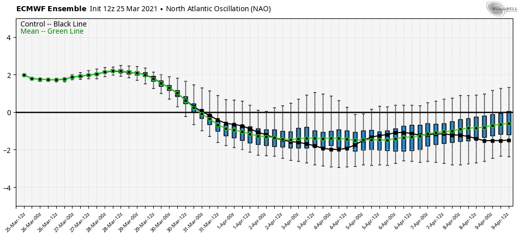
Our next system arrives on Sunday. Unfortunately the NAO didn’t drop fast enough to hold some cold in here for the majority of the east. The drop is projected for 3/31 or 4/1 rather than over the weekend. The White Mountains and most mountains north of Route 2 in Maine will be the exceptions for this particular storm. Rainfall of .50-1.00″ is possible – and wet snow accumulations of 3-6″ for high elevations in the areas outlined above. Heavy rain and high wind should be expected on Sunday, and a cold blast with even higher wind expected for Monday. Another front/low pressure arrives on 4/1 to continue this very active weather pattern. With a negative NAO, natural snow may not be completely done just yet. We’ve had large events in April for many years now, so it’s certainly not out of the question.