The cold was certainly short lived into this morning and we’ve quickly warmed up, with a continual warming trend expected throughout the week.
Looking into the week ahead, we have temperatures that will routinely be in the 50’s during the day, and likely some inversions (especially at lower elevation bases) at night with light wind.
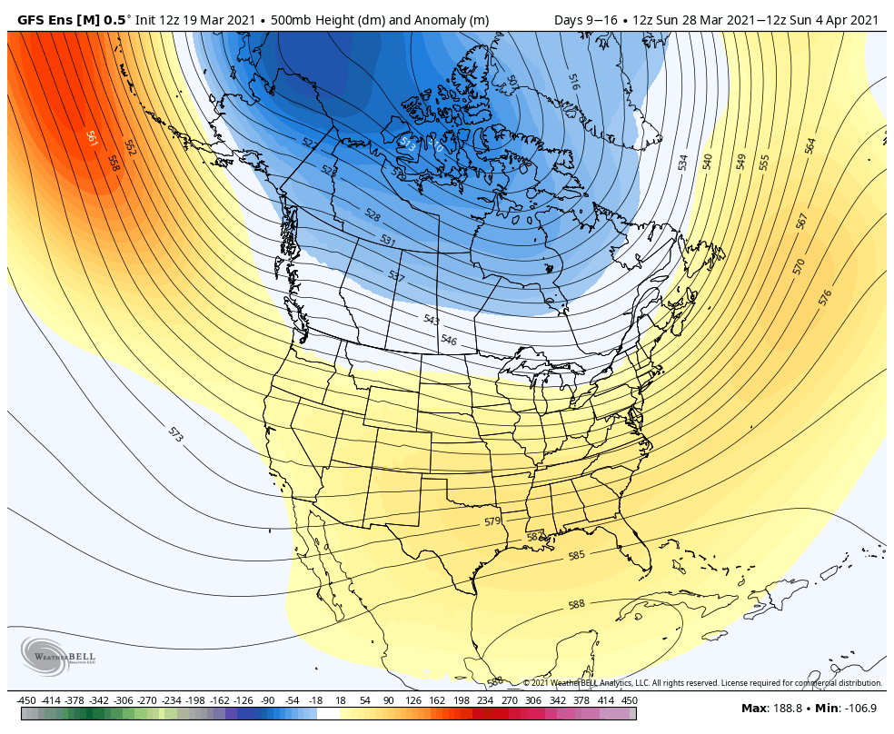
We’ll have a system come through late in the week which should bring some light rain along with a temperature drop, but it doesn’t look like until we get closer to the last few days of the month or first few of April that we see those temperatures start to come back toward a winter level. Even then, it looks brief. However, the NAO shifts negative toward that time frame too, which is similar to what we saw happen last season, as April and even early May turned into fairly snowy time periods. Combine that negative trend with a lack of precipitation in the 2 weeks prior, and we could be seeing a volatile pattern return for early spring (similar to late Jan/early Feb after a quiet Jan).
The GFS hints at this – the Euro doesn’t as much but that’s typical with the Euro as it likes to see warm.