The weather pattern is going to calm down from this rollercoaster ride in a couple days, but until then we have some decent temperature movements and a weak low pressure system to move up/along the eastern seaboard. We’ll be fairly warm today with temperatures boosting into the 40’s and 50’s throughout the East, and the incoming system won’t bring clouds until later today into tonight.
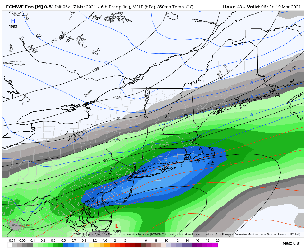
Very light precipitation moves in during the wee hours of Thursday morning, and this could be either freezing drizzle, drizzle or flurry activity depending on temperatures at each elevation. The actual low pressure system make its closest pass to us overnight Thursday into early Friday morning. Given this is riding along the cold air intrusion for the weekend, we’ll be battling some dry air on the northern extent of the precipitation shield, which doesn’t bode well for any precipitation in much of northern New England, and a change in precipitation type for portions of the Northeast.
Behind this, the cold comes in for the last time until at least the final few days of the month or into April.
The next moderation begins into Sunday and goes through much of next week without any precipitation to speak of. It’ll be a week of fairly quiet wind, bluebird skies, and true spring skiing.