Perhaps the most striking piece to begin with is that a week from today, when the next long range forecast comes out, temperatures may be some 40-60 degrees higher than they are right now. Currently, the peak of the warmth looks to hit on Thursday/Friday after a several day build.
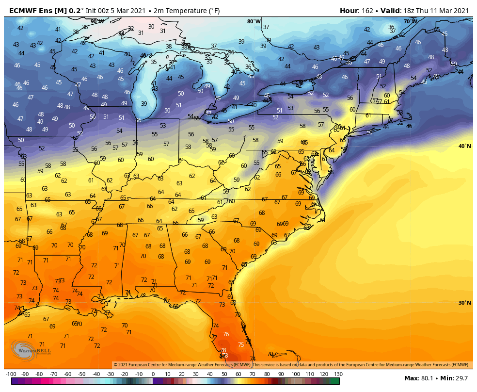
March warmth can be bullish, and it’s looking more likely that we’ll introduce widespread 50’s into New England and the Great Lakes. The peak warmth won’t hold for long as there’s a cold front that will swing through over the weekend. Timing will wobble a bit but likely into the Great Lakes on Friday, and New England on Saturday. This will be false spring #2 for us, as it does look like winter will have another hurrah coming into the third week of March. There are a few signals to this.
The first, is from experience and seasonality. Aside from Winter 2011-2012, a warm spell in March is usually followed by a return of winter, sometimes even more aggressive than the warm up, in both precipitation and temperature. I recall skiing on March 19, 2012 in a t-shirt while the car read 82 degrees pulling up to Sunday River. We’re not that far gone. If we were touching 80’s in New England next week, I’d have a much different tone. However, the last time we hit the 50’s was on Christmas. It’s long overdue to have a swing, and while warm, it’s still manageable, can be recovered from, and will likely have a reinforcing effect on the colder pattern rather than a “toodles to winter” effect.
Another sign is the EPO trending negative. The Eastern Pacific Oscillation is a source region for air masses that end up diving into the western United States. We occasionally bring up the EPO in briefings, however it can vary in output for the Northeast since we also have influence from the North Atlantic Oscillation. A negative EPO certainly is a good sign, but having a negative EPO and negative NAO would be even better. We’re not quite there, but the NAO is closing in on neutral next weekend.
Finally there’s the MJO, the Madden – Julian Oscillation, which correlates convection over the west central equatorial Pacific to incoming cold air masses in the United States. This gets pretty nitty gritty into weather patterns halfway across the world, which can end up in 8 different phases. Each phase has a different outcome depending on what time of year we’re in. Hence, I don’t bring it up much because it can be confusing, and there’s still quite a bit of ongoing research on the MJO. Again, with monitoring conditions on the other side of the world, we have to take it with a grain of salt on the east coast. That being said, it’s entering phases in the mid-end of March that look particularly favorable for the east to see a cold resurgence.
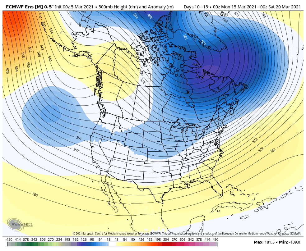
The Euro ensemble, which loves to show an eastern ridge once you get into week 2-3, is pinpointing a fairly amplified eastern trough heading into the week of March 15.
The GFS has a similar overall setup, the trough isn’t as far south as the Euro, which is certainly not the typical case. Knowing model biases and how they usually interact only provides more certainty that the return to winter conditions is more probable for the second half of the month.