Our storm system continues to move through this morning with mixed precipitation and rain in the Mid-Atlantic and even southern New England. Most accumulation remains below 2″, with the exception of the Whites and into Maine where we could pick up 2-4″. This particular system departs this evening ahead of another wave that arrives along our front – which doesn’t come through until Monday.
Most areas will see rain with the wave Sunday, and even substantial rain for the Mid-Atlantic.
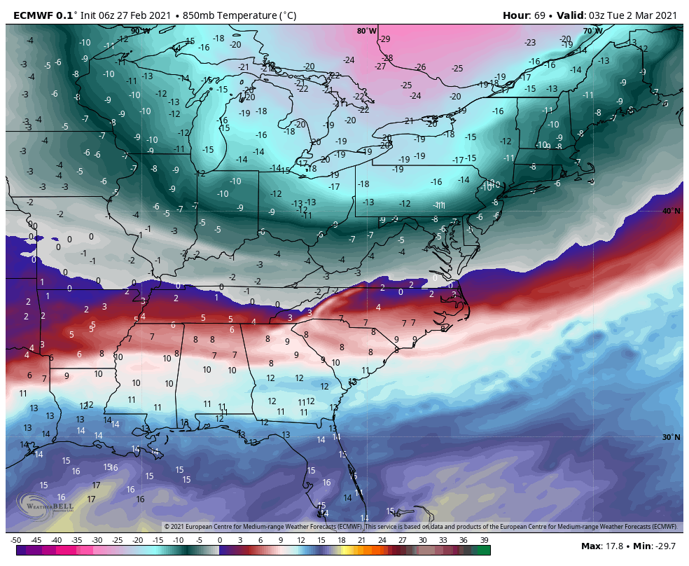
Strong front arrives Monday but the temperature crash won’t be until Monday afternoon into the evening (see 850mb temps in image). This will only hang on for about 48 hours before air begins some moderation midweek. We don’t “warm” up much in the east as the trough hangs back through the end of next week.
There is still a storm signal for next week, but depending on the depth of the arctic intrusion, along with timing of the energy, it may be shunted to the south or offshore.