The incoming system is fairly weak and won’t bring too much excitement north of the Catskills. We’ll stay cloudy through Saturday before the system and lingering snow showers depart. Farther south, another round of sleet and snow can be expected, with a widespread 3-6″.
We’ve hit that point in the winter where we are on a defined cycle – storms roughly on Tuesday and Friday every week. Storms aren’t the same and blocking shifts around, but the overarching pattern is in place until something strong can disturb it.
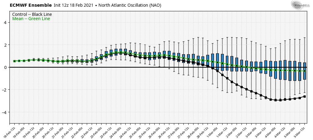
We’ll talk about more it in our long term trends outlook tomorrow, but blocking doesn’t look to reengage until the end of the month, early March. It’s not a deal breaker for snow, but it’s more necessary for us to have entrenched cold air in place in order to keep snow throughout an event.

It also becomes more important to have a negative NAO as we shift into “warmer” and stronger daylight months. Thankfully, we still have no major warmth in sight. The only warm hiccups would occur if storms come in with an unfavorable track, and there’s no blocking or strong cold air in place to hold in the cold.