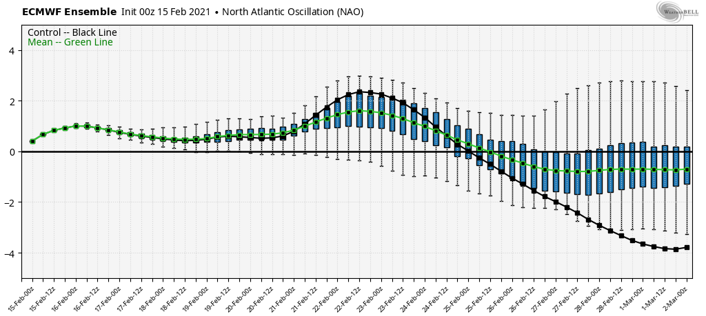
The warm air aloft is winning out with the incoming storm – the NAO has shifted positive, which was a concern in this flip – and therefore we’re not able to hold the cold through the entire column of air. We keep cold at the surface thanks to cold air damming, but that can only work so much without the aid of blocking.
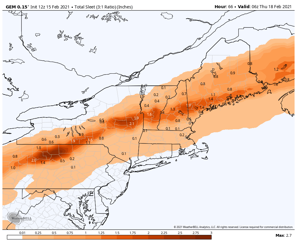
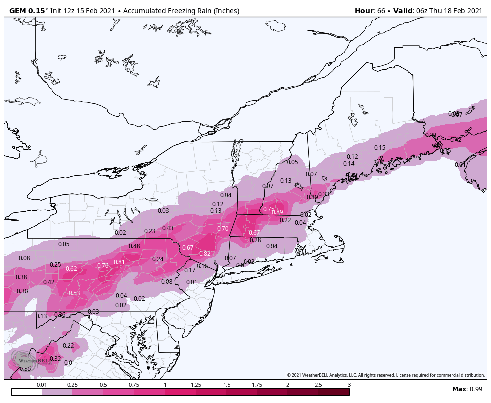
This is going to certainly bring down snow totals, and I doubt we’ll have any area in Northeast that avoids mixing. The farther north you are, the better off you are, but everyone will likely see mixing. The key now will be who can avoid freezing rain, and that is going to be tough south of central VT/NH/ME.
I actually prefer the Canadian output for sleet/freezing rain amounts for the incoming storm. Sleet will be fairly prominent once the warm layer infiltrates from above and it will take time to get that to deepen, yielding more sleet and less freezing rain for many areas in New England. However, that line of strong sleet amounts may be slightly more south. There will be a strong delineation of sleet/snow for the beginning of the storm. South of New England will certainly see more freezing rain.
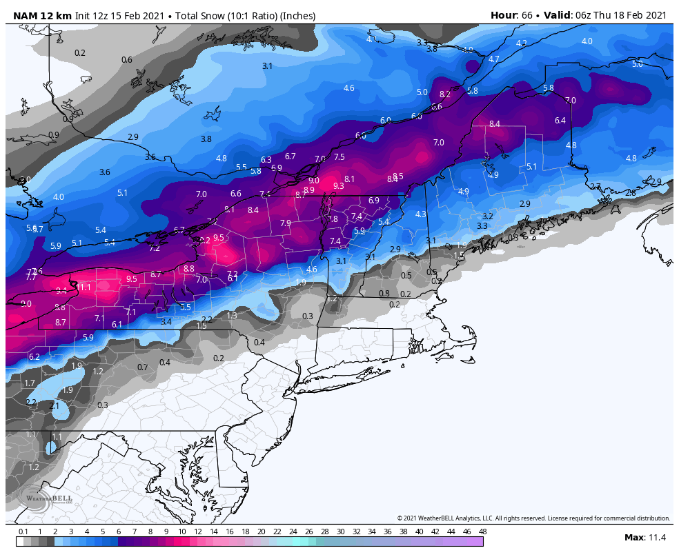
For snowfall, I prefer the NAM accumulation/output.
While the Friday storm is looking better at the moment, I would not be surprised to see it trend closer to how this one is going. The only lucky star we can wish on is that by 2/19, the NAO does approach neutral, and that would keep the cold air (that returns Wednesday), a bit more steadily in place in all layers of the atmosphere. The volatile pattern beats on…