Not too much change with the incoming pieces of energy. We’ll have some very light snow shower activity in New England on Sunday, which may be accompanied by freezing drizzle. The Mid-Atlantic will certainly be dealing with light icing.
The moisture levels for Monday look low, however given a pattern that has strung out pieces of energy overhead, I’m still keeping the chance for drizzle in the forecast.
Incoming larger system arrives in Pennsylvania Monday evening. Roundtop & Liberty are likely to deal with significant icing. The storm departs Tuesday around mid-day with upwards of a half inch of ice possible.
Hunter is on the line for icing/snow; most likely it will start as snow and turn to freezing rain as the warm layer penetrates in from above. Probably 1-3″ of snow followed by .25″ icing, but exact track will be critical to precipitation type.
There’s a chance Mount Snow and Okemo mix in some sleet or freezing rain in low intensity parts of the storm – both beginning and end – which could lead to a glaze. Otherwise amounts of 4-8″ are expected in New England. Should the warm air aloft stay farther from the Greens & Whites, more favorable snow to liquid ratios will yield higher amounts.
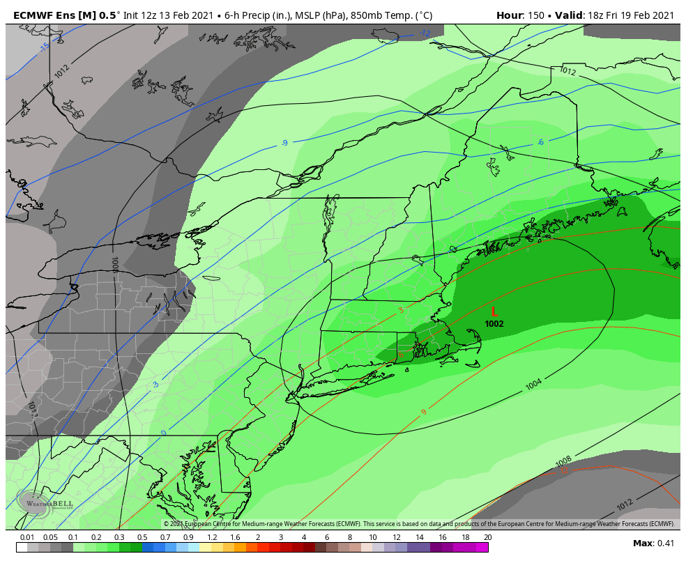
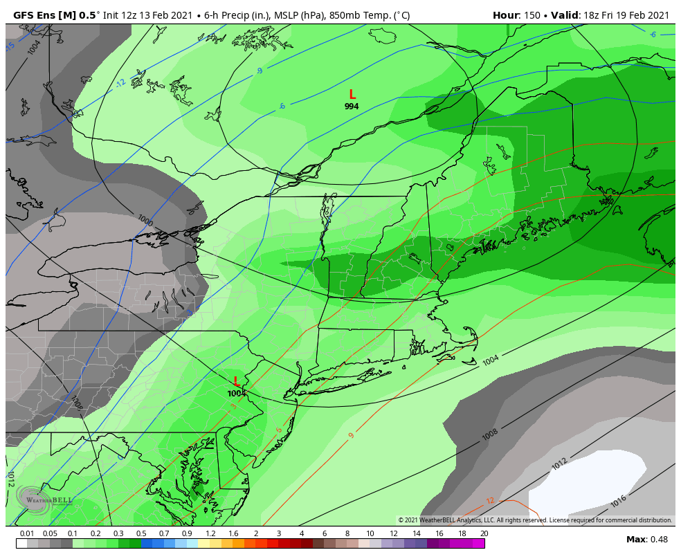
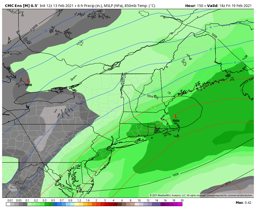
There is still quite a bit of discrepancy on the track for Friday’s system. Given we’re still 6 days out, that’s fairly normal. The piece of energy responsible for the storm arrives onshore in the next 24 hours. At this point, there’s high confidence in mix to rain in PA and NY, with low confidence in mixing for Mount Snow & Okemo. Moderate confidence in a mostly-snow event for the Northern Greens & Whites.