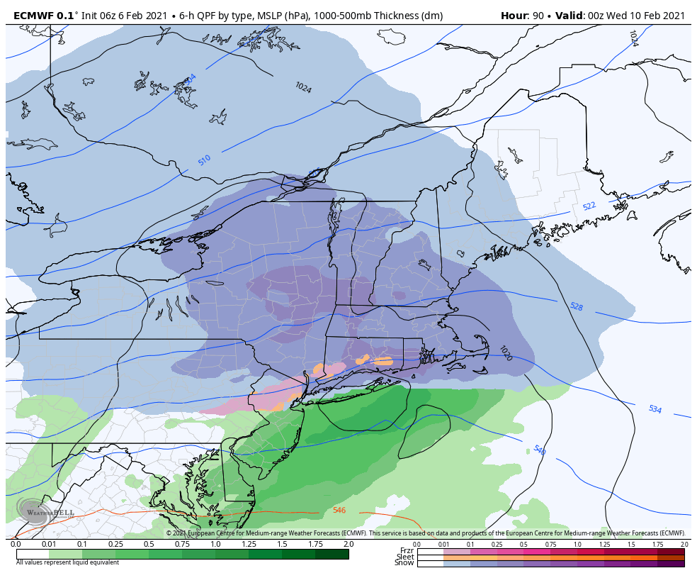
Wind has started to pick up as colder air settles in, especially into tonight. Sunshine has allowed temperatures to warm a bit above forecast, but they will come down quick as the sun angle falls. We’ll have a cold start to Sunday with our incoming system. This will be a fairly low impact, low snowfall system as the low is about 100 miles too far east off the Cape Cod shoreline. However, given low temperatures, ratios will be much higher, and that should lead to a widespread 1-3″ snowfall across the region Sunday evening.
The energy train continues into Tuesday. Once again the models aren’t terribly excited about phasing this energy either, but the low center is closer to the coast. The energy associated with this system comes onshore later tonight, early tomorrow. In this current series of storms, models have been struggling with the strength of these energy centers and their interaction with other energies. Therefore once we can get some upper air data, we’ll have a better idea on how Tuesday plays out. On the current track would allow for some light to moderate snowfall to overspread New England, and it’s possible that the Mid-Atlantic holds onto some cold too – hopefully eliminating any mix potential.
We will have quite the rollercoaster ride with temperatures, so be ready for some swings that may buck the diurnal trends. In the absence of storms, temperatures will likely fall dramatically into single digits or teens, whereas when a system nears, we’ll bounce quickly into the 20’s, and even 30’s – location dependent of course.
Finally, we have another storm with sights on the east coast on Friday. Without the previous two storms tapping into the energy field in a strong way, it’s possible that one of these shows up in a big way. Previously, models hinted at this for Tuesday’s system, but now they are looking more closely at Friday’s. This could simply be a bias, given that it’s happened a lot already this season, but there have been times it’s come to fruition (last Tuesday). We’ll have a system come every 2-3 days for a while, so we have some good opportunities.
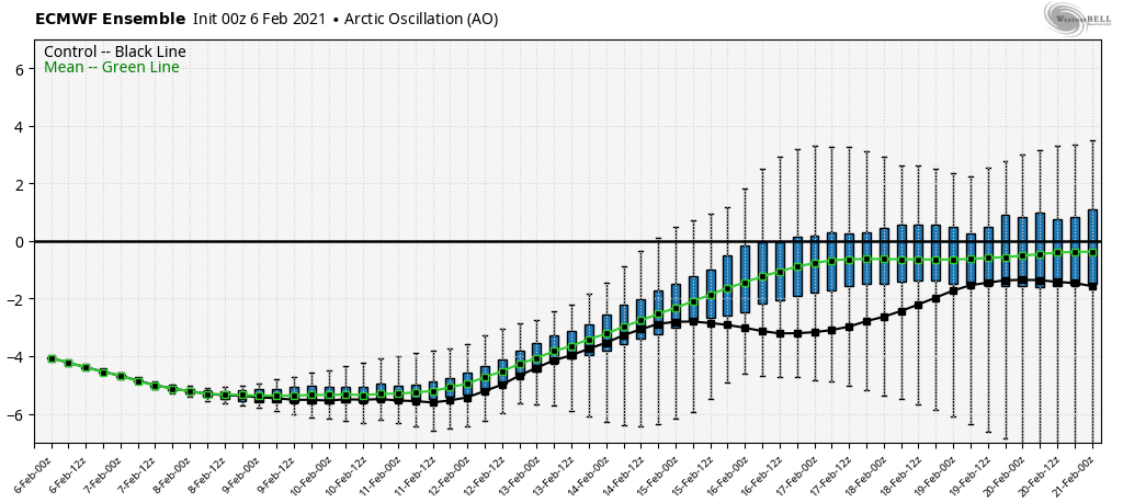
The NAO, which is strongly negative now and partially a reason for the lackluster performance of the snow tomorrow, is starting its ascent toward neutral beginning early this week. Weakening the negative NAO should allow for some more storms to be impactful to the Northeast, which models have already picked up on. Therefore this precipitation pattern will likely continue into the end of the month. However, on top of this, the AO begins to turn course as well and move toward neutral. This is the more troublesome part as we may lose the cold dome that we’ve been able to hold on to for weeks now. The “happy place” would be finding a weak-moderate negative in both of these teleconnections to allow for storms to form and move up the east coast, while at the same time we hold the cold.