Snow showers continue today as wind gradually lessens throughout the day. We’ll have some colder air come in tonight, though it will be a bit short lived as a weak impulse of energy comes in Wednesday. This will spark a slow rise in temperatures for Wednesday, but cold air returns for Thursday. This happens again on Friday before we go into our deepest cold of the season for this weekend. Wind may be a concern this weekend.
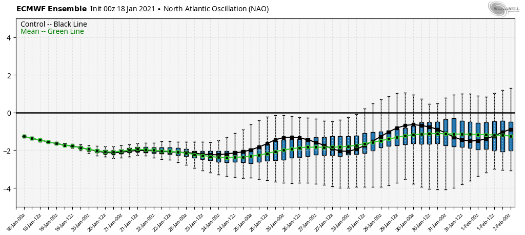
Our focus for our next system turns to 1/25-1/26, as models are picking up on a coastal storm. Models have done this frequently without many coming to fruition, so I’m not completely sold, however the NAO extended shows a fair amount of undulation in the members, which typically indicates an active pattern.
