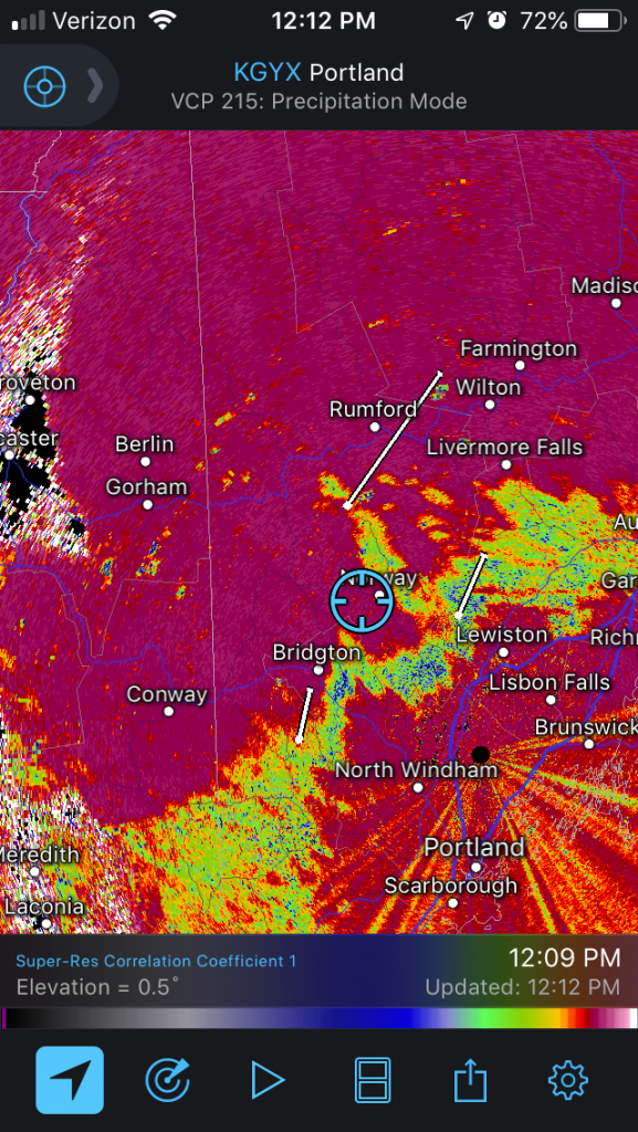
The storm continues to move through New England this morning with a variety of precipitation. Most areas above 1,000 feet have done fairly well, and we’ll continue to see the snow pile up in the higher elevations. In terms of the “battleground” between rain and snow, it’s been over my house in Norway, Maine and back toward Lake Winnipesaukee. For those that use Radarscope or other radar products, the correlation coefficient is great to see precipitation type changes. This was a huge upgrade to the WSR – D88 radars several years ago, adding in dual polarization, meaning it’s looking at both the vertical and horizontal components of what the beam encounters. It compares the structure and moisture factor of what’s falling to other particles around it. Therefore when you have precipitation type changes, it’s highlighted because structure changes and the features are not uniform, and the correlation coefficient is high (snow to rain, snow to sleet to rain, etc).
It’s certainly a wet snow, and the wind stays sustained on a high note through most of the day and into Sunday. The low is right near the NH/VT/MA line as of noon, and will continue on its northeastward track through the remainder of the day. The upslope snow machine will continue from here on out.
Our attention now turns to the week ahead. Wind begins to die down on Monday, though it will still be elevated. We have two weak systems to come in on the 20th and 22th – these won’t produce much more than some light snow showers. In between those two systems we have a quick arctic punch, and another one to follow from the 23-25th before another system may impact us on the 26th.
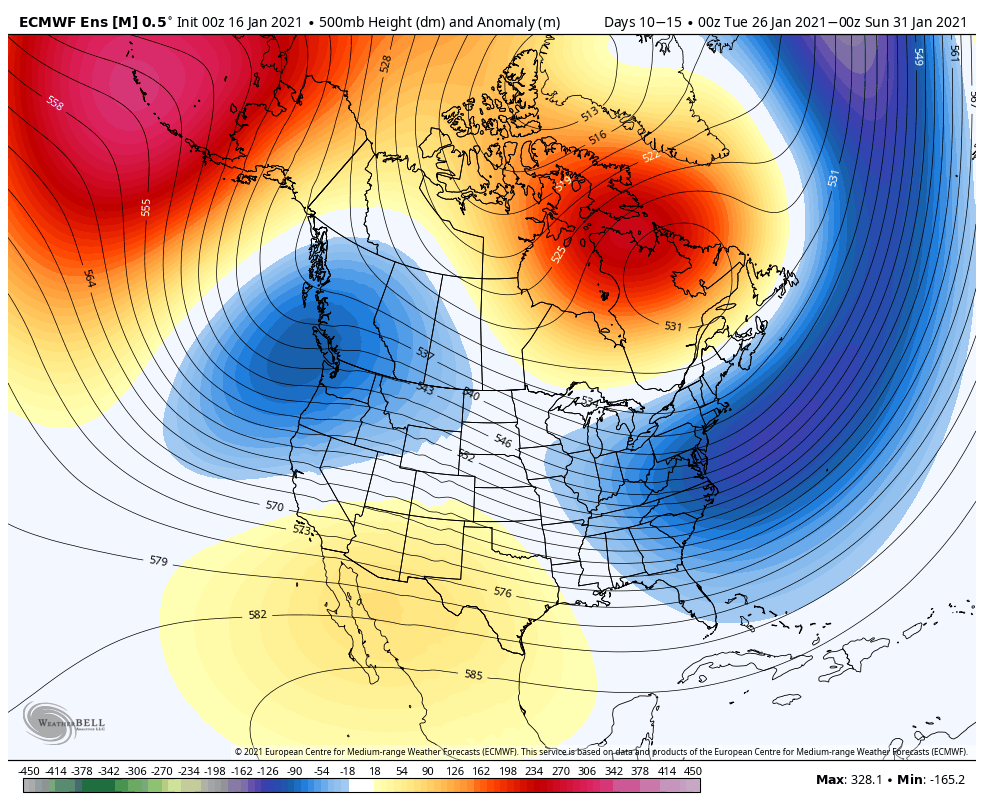
The long-term trend is certainly cold. Looking at the 500mb height anomaly, we see the higher heights remaining in the Arctic and the lower heights on the east and west coasts. This is indicative of a fairly active and cold pattern with a trough in the east and the pacific northwest.