The low placement continues to be of key concern heading into Saturday’s cold front moving through the region. Models continue to try to decipher where the rain/snow line will form, and elevation will play a big role in precipitation type too. We have a negative AO & NAO, which should theoretically hold some cold air while the low battles it out.
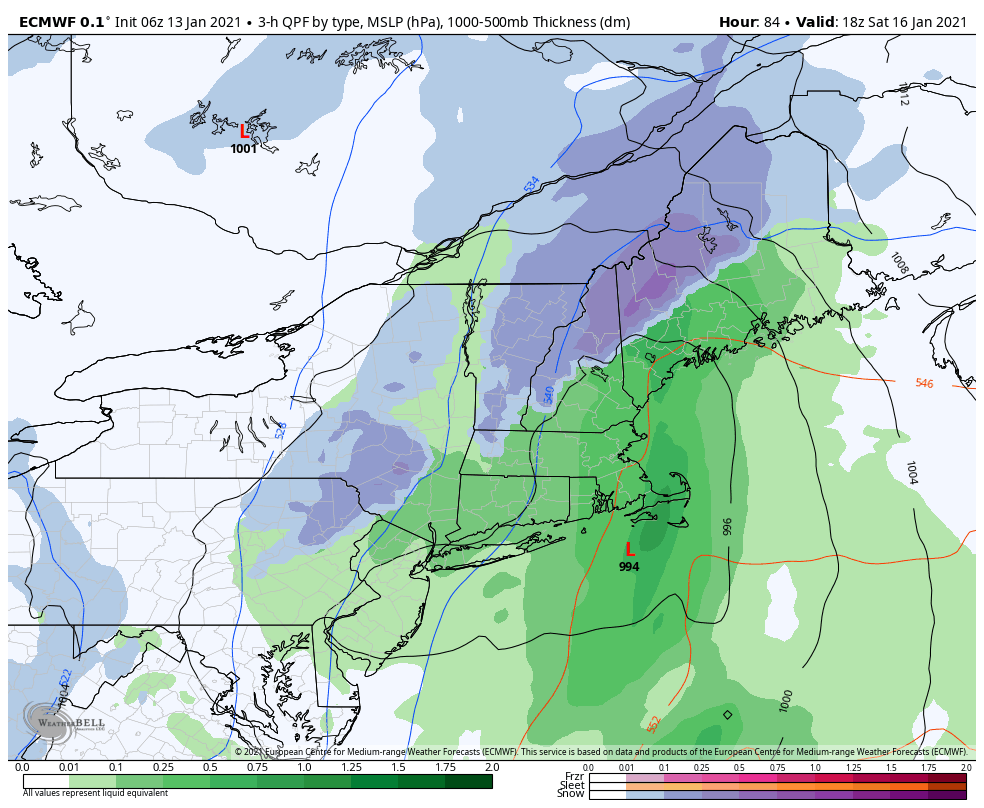
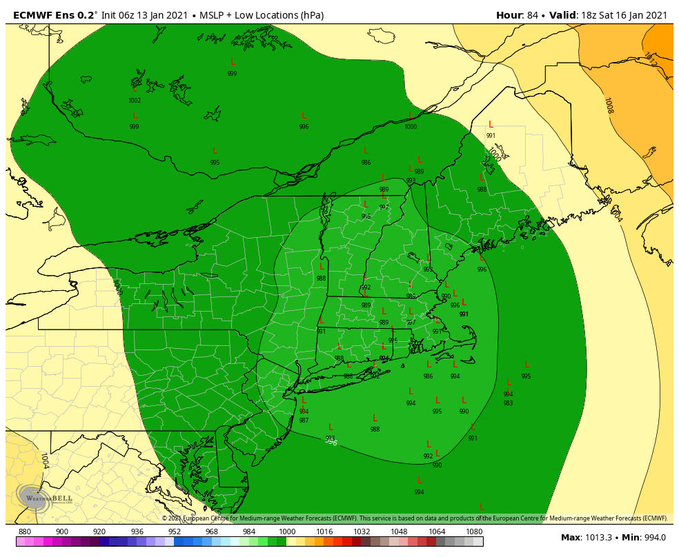
Notice the rain/snow line in the European model hugging the mountain ranges. The low placement is actually fairly favorable in the 6z run. The mean low position in the ensembles however, is in northern Rhode Island.
The ensemble low positions are fairly congregated closer to the Euro deterministic run that we see, which is favorable for more snow than rain for New England.
The GFS model has been trying to split up the pieces of energy up the front, which actual leads to a colder solution for the majority of the precipitation. The NAM is fairly warm and lends itself to the Euro solution of a one larger system, as opposed to the GFS split energy idea.
We should start to see more alignment coming into the evening as the piece of energy responsible for the this low and attending coastal low came onshore this morning – it may have been too early for the morning balloon launches to pick up on.
Colder air plunges in after the low leaves later Saturday, increasing wind, cooling us down, and providing favored NW slopes some decent upslope slows.