A cold morning across most of the Northeast with fresh snow and calm wind. Expect inversions to hold through most of the morning with another bluebird day.
Clouds begin to stream in from the west as a weak impulse moves in from the Great Lakes, which is bringing some light snow and rain showers there this morning. This arrives closer to Sunday afternoon, and will bring light snow showers through Monday.
There’s a bit of a rollercoaster ride with temperatures Monday/Tuesday – you’ll notice that we may have steady or falling temperatures during the day and slightly rising temperatures at night. This is due to a few quick impulses coming in from Sunday to Tuesday. We’ll cool down on Wednesday ahead of the system Thursday.
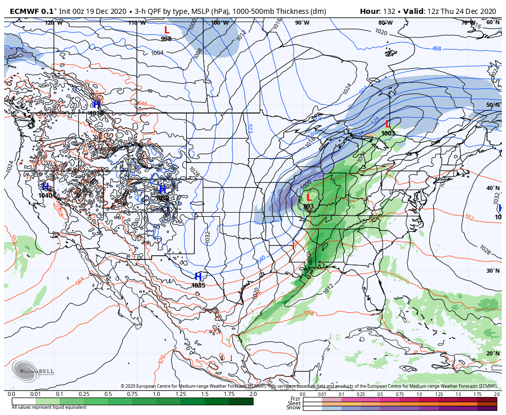
At this point there are more signs toward a warm system on Christmas Eve and Christmas in the Northeast. It energizes in the Great Lakes and looks to take an inside runner path, at least at the moment. Our best case scenario would be to avoid a phasing of the energies, similar to what happened closer to Thanksgiving. The energy involved with the bulk of this system arrives onshore in the Pacific early Tuesday morning. Despite it being warmer and potentially rainy…it looks like this may be a re-engaging system to the pattern, given what we see coming after it.
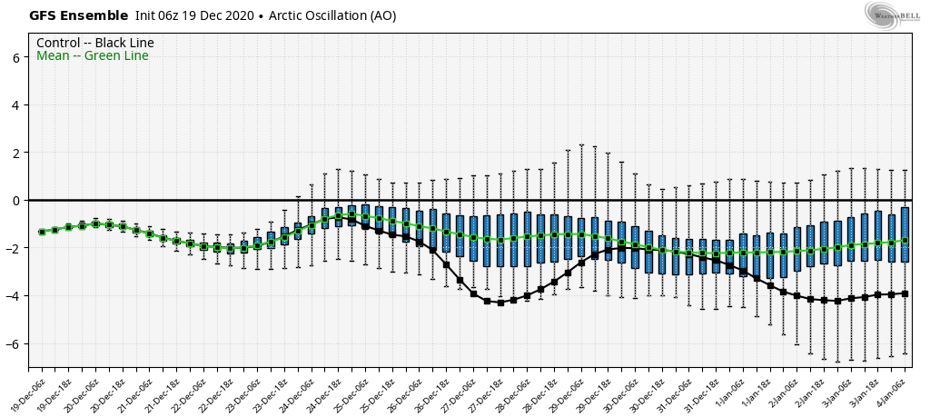
Behind this system, a cold pattern prevails through the rest of the vacation time period. Notice the GFS Arctic Oscillation has very few positive ensemble members. Therefore we’ll at least have opportunities to get the snow guns on after a potential rain event.